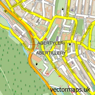
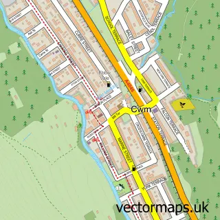
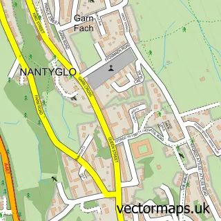
This Cwmtillery street map is a detailed vector street map covering a 750m x 750m area. Select a larger area to create and download your own vector street map of Cwmtillery.
The 750-metre map sample for Cwmtillery covers 139 mapped buildings and approximately 42.5 km of road detail, of which 9 named roads are named. The immediate area includes 5 MOT stations within 2 miles. The wider area around Cwmtillery features 2 tourism points of interest and 1 food and drink venue. To create a larger or custom map of Cwmtillery, the map builder lets you define your own coverage area and download editable SVG, PDF and PNG files.
Create a larger editable map of Cwmtillery
Choose any area you need and generate a high-quality vector map instantly. Perfect for print, planning, design, business and personal use.

This Cwmtillery street map in Gwent is available as downloadable SVG, PDF and PNG map files, or as a printed map for planning, business, display, education, local information and design work. You can also create a larger custom map area using the map selector.
What this Cwmtillery map sample shows
Cwmtillery lies within Abertillery Community parish, part of Cwmtillery ward in the Blaenau Gwent - Blaenau Gwent local authority area. The postcode geography for this area includes the NP postcode area, the NP13 postcode district and the NP13 1 postcode sector. Residents fall under the Aneurin Bevan University Health Board for NHS services.
Local features near Cwmtillery
Within 2 milesAmenities and services in and around Cwmtillery.
Administrative and postcode information for Cwmtillery
Cwmtillery lies within Abertillery Community parish, part of Cwmtillery ward in the Blaenau Gwent - Blaenau Gwent local authority area. The postcode geography for this area includes the NP postcode area, the NP13 postcode district and the NP13 1 postcode sector. Residents fall under the Aneurin Bevan University Health Board for NHS services.
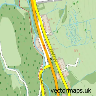
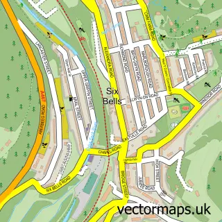
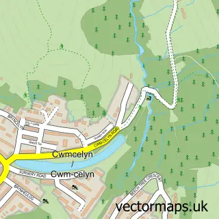
Nearby street map samples around Cwmtillery

More street maps in Gwent
750 metre map area coverage
Boundary, postcode and point of interest information for the 750m x 750m rectangle centred on this sample map.
Boundaries containing map centre
Constituency: Blaenau Gwent and Rhymney Co Const
District: Blaenau Gwent - Blaenau Gwent
Icb: Aneurin Bevan University
Parish: Abertillery Community
Police Force: gwent
Postcode District: NP13
Postcode Sector: NP13 1
Nearby boundaries intersecting sample
No additional intersecting boundaries found.
Postcode coverage
POI category counts
Building Supply Store: 3
Furniture Store: 2
Professional Services: 2
Used Car Dealer: 2
Attractions And Activities: 1
Automotive Repair: 1
Automotive Services And Repair: 1
Builders: 1
Business Management Services: 1
Cafe: 1
Sample points of interest
- Woodland Field
- Cross mobile mechanics
- Bits & PC's
- Mww Maintenance Ltd.
- Fluid Emergency Plumbers
- Mark Wallace Electrical Ltd
- Travis Perkins
- M G Heating Solutions Ltd.
- Caffi Tyleri
- Pentref Tyleri
- Connected Kerb Charging Station
- Beacons Rattan
Create a larger editable map of Cwmtillery
This sample shows only a 750 metre area. To create a larger map of Cwmtillery, use our map builder to choose your own coverage area, add titles and download editable SVG, PDF and PNG files.
Create a custom map of Cwmtillery