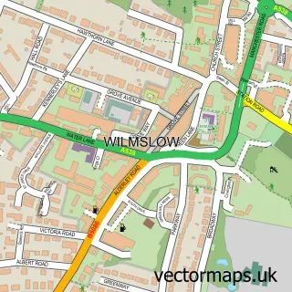
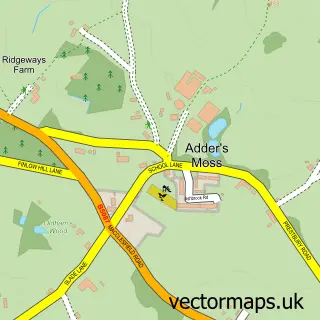
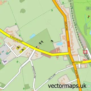
This Alderley Edge street map is a detailed vector street map covering a 750m x 750m area. Select a larger area to create and download your own vector street map of Alderley Edge.
The 750-metre map sample for Alderley Edge covers 330 mapped buildings and approximately 17.9 km of road detail, of which 35 named roads are named. The immediate area includes 2 schools, 1 railway station, 3 GP surgeries within 2 miles and 2 pubs among other local services. The wider area around Alderley Edge features 4 tourism points of interest and 3 food and drink venues. To create a larger or custom map of Alderley Edge, the map builder lets you define your own coverage area and download editable SVG, PDF and PNG files.
Create a larger editable map of Alderley Edge
Choose any area you need and generate a high-quality vector map instantly. Perfect for print, planning, design, business and personal use.

This Alderley Edge street map in Cheshire is available as downloadable SVG, PDF and PNG map files, or as a printed map for planning, business, display, education, local information and design work. You can also create a larger custom map area using the map selector.
What this Alderley Edge map sample shows
Alderley Edge lies within Alderley Edge Cp parish, part of Alderley Edge ward in the Cheshire East (B) local authority area. The postcode geography for this area includes the SK postcode area, the SK9 postcode district and the SK9 7 postcode sector. Residents fall under the Nhs Cheshire And Merseyside Integrated Care Board for NHS services.
Local features near Alderley Edge
Within 2 milesAmenities and services in and around Alderley Edge.
Administrative and postcode information for Alderley Edge
Alderley Edge lies within Alderley Edge Cp parish, part of Alderley Edge ward in the Cheshire East (B) local authority area. The postcode geography for this area includes the SK postcode area, the SK9 postcode district and the SK9 7 postcode sector. Residents fall under the Nhs Cheshire And Merseyside Integrated Care Board for NHS services.
Nearby street map samples around Alderley Edge

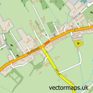
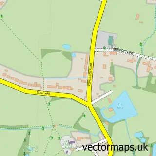
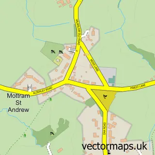
More street maps in Cheshire
750 metre map area coverage
Boundary, postcode and point of interest information for the 750m x 750m rectangle centred on this sample map.
Boundaries containing map centre
Constituency: Tatton Co Const
District: Cheshire East (B)
Icb: NHS Cheshire and Merseyside ICB
Parish: Alderley Edge CP
Police Force: cheshire
Postcode District: SK9
Postcode Sector: SK9 7
Ward: Alderley Edge Ward
Nearby boundaries intersecting sample
No additional intersecting boundaries found.
Postcode coverage
POI category counts
Beauty And Spa: 4
Church Cathedral: 4
Doctor: 4
Gas Station: 4
Professional Services: 4
Dentist: 3
Home Developer: 3
It Service And Computer Repair: 3
Package Locker: 3
Physical Therapy: 3
Sample points of interest
- John Wallace Advertising Copywriter
- Time54 - Construction Marketing Specialists
- Aldeli
- F P A Architects
- Brookview Care Home - Bupa
- Alderley Edge Copper Mines
- Heyes Lane Allotments
- Wizard Sports and Classics
- Amber Car Leasing
- Luna Customs LLP
- Voly
- Barclays Local
Create a larger editable map of Alderley Edge
This sample shows only a 750 metre area. To create a larger map of Alderley Edge, use our map builder to choose your own coverage area, add titles and download editable SVG, PDF and PNG files.
Create a custom map of Alderley Edge