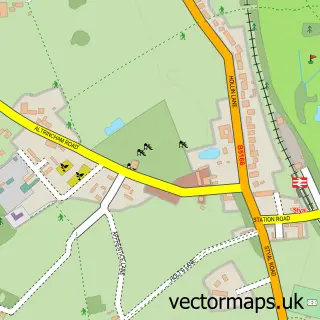
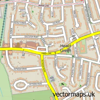
This Dean Row street map is a detailed vector street map covering a 750m x 750m area. Select a larger area to create and download your own vector street map of Dean Row.
The 750-metre map sample for Dean Row covers 184 mapped buildings and approximately 9.4 km of road detail, of which 16 named roads are named. The immediate area includes 3 GP surgeries within 2 miles and 10 MOT stations within 2 miles. The wider area around Dean Row features 1 tourism point of interest. To create a larger or custom map of Dean Row, the map builder lets you define your own coverage area and download editable SVG, PDF and PNG files.
Create a larger editable map of Dean Row
Choose any area you need and generate a high-quality vector map instantly. Perfect for print, planning, design, business and personal use.

This Dean Row street map in Cheshire is available as downloadable SVG, PDF and PNG map files, or as a printed map for planning, business, display, education, local information and design work. You can also create a larger custom map area using the map selector.
What this Dean Row map sample shows
Dean Row lies within Wilmslow Cp parish, part of Wilmslow Dean Row ward in the Cheshire East (B) local authority area. The postcode geography for this area includes the SK postcode area, the SK9 postcode district and the SK9 2 postcode sector. Residents fall under the Nhs Cheshire And Merseyside Integrated Care Board for NHS services.
Local features near Dean Row
Within 2 milesAmenities and services in and around Dean Row.
Administrative and postcode information for Dean Row
The local authority covering Dean Row is Cheshire East (B), within the county of Cheshire. The settlement lies within Wilmslow Dean Row ward and Wilmslow Cp civil parish. The SK9 postcode district and SK9 2 postcode sector serve the immediate area. NHS provision in the area is delivered through Manchester University Nhs Foundation Trust.
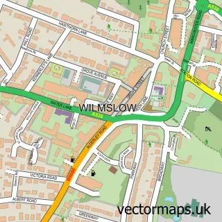
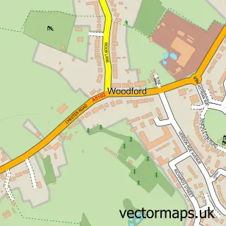
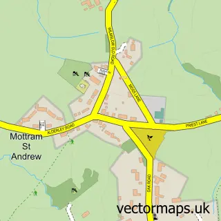
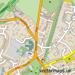
Nearby street map samples around Dean Row

More street maps in Cheshire
750 metre map area coverage
Boundary, postcode and point of interest information for the 750m x 750m rectangle centred on this sample map.
Boundaries containing map centre
Constituency: Tatton Co Const
District: Cheshire East (B)
Icb: NHS Cheshire and Merseyside ICB
Parish: Wilmslow CP
Police Force: cheshire
Postcode District: SK9
Postcode Sector: SK9 2
Ward: Wilmslow Dean Row Ward
Nearby boundaries intersecting sample
No additional intersecting boundaries found.
Postcode coverage
POI category counts
Advertising Agency: 2
Child Care And Day Care: 1
Community Center: 1
Dance School: 1
Driving School: 1
Nursing School: 1
Park: 1
Preschool: 1
Retirement Home: 1
Wholesale Store: 1
Sample points of interest
- D P M
- Vanda Murray Associates
- Schools Out Wilmslow
- Dean Row Village Hall
- Dean Row School of Dance
- Pass Faster - Intensive Driving Courses
- Hazelmere House Care Home - Bupa
- Brown's Lane Park
- Jabberjacks
- Bupa UK
- County Milk Products Ltd
Create a larger editable map of Dean Row
This sample shows only a 750 metre area. To create a larger map of Dean Row, use our map builder to choose your own coverage area, add titles and download editable SVG, PDF and PNG files.
Create a custom map of Dean Row