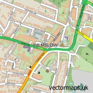
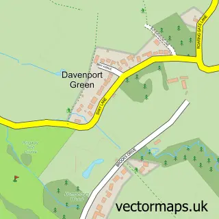
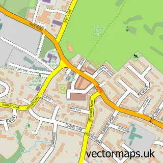
This Styal street map is a detailed vector street map covering a 750m x 750m area. Select a larger area to create and download your own vector street map of Styal.
The 750-metre map sample for Styal covers 99 mapped buildings and approximately 6.2 km of road detail, of which 7 named roads are named. The immediate area includes 1 school, 1 railway station, 6 GP surgeries within 2 miles and 1 pub among other local services. The wider area around Styal features 3 tourism points of interest and 5 food and drink venues. To create a larger or custom map of Styal, the map builder lets you define your own coverage area and download editable SVG, PDF and PNG files.
Create a larger editable map of Styal
Choose any area you need and generate a high-quality vector map instantly. Perfect for print, planning, design, business and personal use.

This Styal street map in Cheshire is available as downloadable SVG, PDF and PNG map files, or as a printed map for planning, business, display, education, local information and design work. You can also create a larger custom map area using the map selector.
What this Styal map sample shows
Styal lies within Styal Cp parish, part of Wilmslow Lacey Green ward in the Cheshire East (B) local authority area. The postcode geography for this area includes the SK postcode area, the SK9 postcode district and the SK9 4 postcode sector. Residents fall under the Nhs Cheshire And Merseyside Integrated Care Board for NHS services.
Local features near Styal
Within 2 milesAmenities and services in and around Styal.
Administrative and postcode information for Styal
Styal lies within Styal Cp parish, part of Wilmslow Lacey Green ward in the Cheshire East (B) local authority area. The postcode geography for this area includes the SK postcode area, the SK9 postcode district and the SK9 4 postcode sector. Residents fall under the Nhs Cheshire And Merseyside Integrated Care Board for NHS services.
Nearby street map samples around Styal

More street maps in Cheshire
750 metre map area coverage
Boundary, postcode and point of interest information for the 750m x 750m rectangle centred on this sample map.
Boundaries containing map centre
Constituency: Tatton Co Const
District: Cheshire East (B)
Icb: NHS Cheshire and Merseyside ICB
Parish: Styal CP
Police Force: cheshire
Postcode District: SK9
Postcode Sector: SK9 4
Ward: Wilmslow Lacey Green Ward
Nearby boundaries intersecting sample
No additional intersecting boundaries found.
Postcode coverage
POI category counts
Cafe: 2
Package Locker: 2
Park: 2
Sports Club And League: 2
Train Station: 2
Active Life: 1
Church Cathedral: 1
Coffee Shop: 1
Elementary School: 1
Executive Search Consultants: 1
Sample points of interest
- Styal Tennis Club
- Earlam's
- Quarry Bank Mill Garden Café
- Norcliffe Chapel
- Earlams Store, Cafe, Arts and Crafts
- Styal Primary School
- Jordan Sheppard
- Halo Furnishings
- Layer Landscape Architecture
- Caritas Services
- Earlams Store Cafe & Gallery
- IQ Media Group
Create a larger editable map of Styal
This sample shows only a 750 metre area. To create a larger map of Styal, use our map builder to choose your own coverage area, add titles and download editable SVG, PDF and PNG files.
Create a custom map of Styal