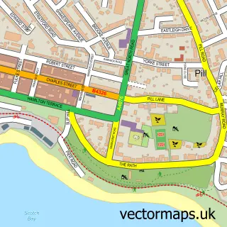
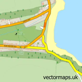
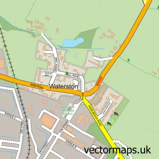
This Angle street map is a detailed vector street map covering a 750m x 750m area. Select a larger area to create and download your own vector street map of Angle.
The 750-metre map sample for Angle covers 107 mapped buildings and approximately 4.5 km of road detail, of which 1 named road are named. The immediate area includes 1 pub. The wider area around Angle features 5 tourism points of interest, 1 food and drink venue and 1 hotel. To create a larger or custom map of Angle, the map builder lets you define your own coverage area and download editable SVG, PDF and PNG files.
Create a larger editable map of Angle
Choose any area you need and generate a high-quality vector map instantly. Perfect for print, planning, design, business and personal use.

This Angle street map in Dyfed is available as downloadable SVG, PDF and PNG map files, or as a printed map for planning, business, display, education, local information and design work. You can also create a larger custom map area using the map selector.
What this Angle map sample shows
Angle lies within Angle Community parish, part of Hundleton ward in the Sir Benfro - Pembrokeshire local authority area. The postcode geography for this area includes the SA postcode area, the SA71 postcode district and the SA71 5 postcode sector. Residents fall under the Hywel Dda University Health Board for NHS services.
Local features near Angle
Within 2 milesAmenities and services in and around Angle.
Administrative and postcode information for Angle
Angle lies within Angle Community parish, part of Hundleton ward in the Sir Benfro - Pembrokeshire local authority area. The postcode geography for this area includes the SA postcode area, the SA71 postcode district and the SA71 5 postcode sector. Residents fall under the Hywel Dda University Health Board for NHS services.
Nearby street map samples around Angle

More street maps in Dyfed
750 metre map area coverage
Boundary, postcode and point of interest information for the 750m x 750m rectangle centred on this sample map.
Boundaries containing map centre
Constituency: Mid and South Pembrokeshire Co Const
District: Sir Benfro - Pembrokeshire
Icb: Hywel Dda
Parish: Angle Community
Police Force: dyfed-powys
Postcode District: SA71
Postcode Sector: SA71 5
Nearby boundaries intersecting sample
No additional intersecting boundaries found.
Postcode coverage
POI category counts
Landmark And Historical Building: 4
Post Office: 2
Ambulance And Ems Services: 1
Campground: 1
Church Cathedral: 1
Convenience Store: 1
Cottage: 1
Elementary School: 1
Emergency Service: 1
Hotel: 1
Sample points of interest
- Royal National Lifeboat Institution
- Castle Farm Camping and Self Catering
- Sailors' Chapel, Angle
- Angle Village Shop
- Bluebell Cottage
- Angle V C School
- RNLI Angle Lifeboat Station
- The Globe Angle
- Angle Castle
- Dovecote, Angle
- Pele Tower
- Stackpole Walled Gardens
Create a larger editable map of Angle
This sample shows only a 750 metre area. To create a larger map of Angle, use our map builder to choose your own coverage area, add titles and download editable SVG, PDF and PNG files.
Create a custom map of Angle