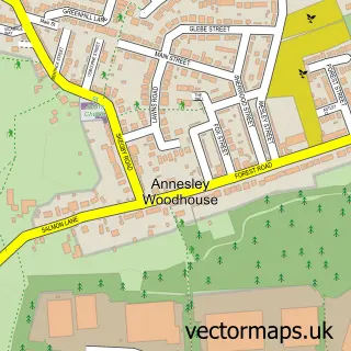
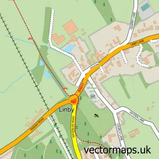
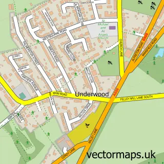
This Annesley street map is a detailed vector street map covering a 750m x 750m area. Select a larger area to create and download your own vector street map of Annesley.
The 750-metre map sample for Annesley covers 631 mapped buildings and approximately 22.7 km of road detail, of which 30 named roads are named. The immediate area includes 1 school, 6 GP surgeries within 2 miles, 1 pub and 7 MOT stations within 2 miles. The wider area around Annesley features 1 tourism point of interest and 2 food and drink venues. To create a larger or custom map of Annesley, the map builder lets you define your own coverage area and download editable SVG, PDF and PNG files.
Create a larger editable map of Annesley
Choose any area you need and generate a high-quality vector map instantly. Perfect for print, planning, design, business and personal use.

This Annesley street map in Nottinghamshire is available as downloadable SVG, PDF and PNG map files, or as a printed map for planning, business, display, education, local information and design work. You can also create a larger custom map area using the map selector.
What this Annesley map sample shows
Annesley lies within Annesley Cp parish, part of Annesley & Kirkby Woodhouse ward in the Ashfield District local authority area. The postcode geography for this area includes the NG postcode area, the NG17 postcode district and the NG17 9 postcode sector. Residents fall under the Nhs Nottingham And Nottinghamshire Integrated Care Board for NHS services.
Local features near Annesley
Within 2 milesAmenities and services in and around Annesley.
Administrative and postcode information for Annesley
The local authority covering Annesley is Ashfield District, within the county of Nottinghamshire. The settlement lies within Annesley & Kirkby Woodhouse ward and Annesley Cp civil parish. The NG17 postcode district and NG17 9 postcode sector serve the immediate area. NHS provision in the area is delivered through Sherwood Forest Hospitals Nhs Foundation Trust.
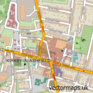
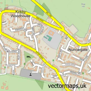
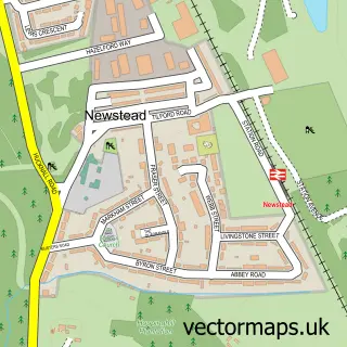
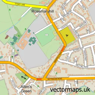
Nearby street map samples around Annesley

More street maps in Nottinghamshire
750 metre map area coverage
Boundary, postcode and point of interest information for the 750m x 750m rectangle centred on this sample map.
Boundaries containing map centre
Constituency: Ashfield Co Const
County: Nottinghamshire County
District: Ashfield District
Icb: NHS Nottingham and Nottinghamshire ICB
Police Force: nottinghamshire
Postcode District: NG17
Postcode Sector: NG17 9
Ward: Annesley & Kirkby Woodhouse Ward
Nearby boundaries intersecting sample
Parish: Annesley CP
Postcode District: NG15
Postcode Sector: NG15 0
Postcode coverage
POI category counts
Beauty Salon: 3
Bridal Shop: 2
Convenience Store: 2
Professional Services: 2
Alternative Medicine: 1
Antenna Service: 1
Arts And Crafts: 1
Assisted Living Facility: 1
Atms: 1
Automation Services: 1
Sample points of interest
- Holistic Health by Julieanne
- Central Installations
- ODEF Creative Community Centre
- Belmont Road
- Shell Derby Road, Annesley
- Electric Gates UK
- Hair By Stacey
- Serenity Cabin
- The C.L.E Beauty Salon and Training Academy
- Sherwood Cottage
- Sapphire Vogue Vintage Classic Hire
- Seats & Sashes
Create a larger editable map of Annesley
This sample shows only a 750 metre area. To create a larger map of Annesley, use our map builder to choose your own coverage area, add titles and download editable SVG, PDF and PNG files.
Create a custom map of Annesley