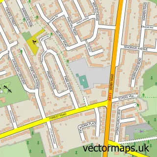
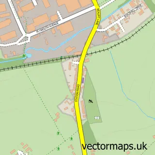
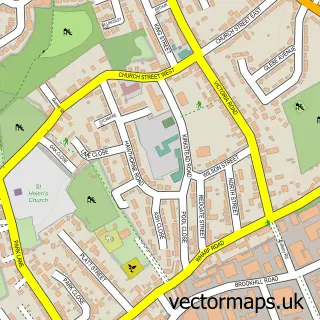
This Kirkby-in-Ashfield street map is a detailed vector street map covering a 750m x 750m area. Select a larger area to create and download your own vector street map of Kirkby-in-Ashfield.
The 750-metre map sample for Kirkby-in-Ashfield covers 438 mapped buildings and approximately 25.9 km of road detail, of which 38 named roads are named. The immediate area includes 1 primary school and 1 secondary school, 5 GP surgeries, with 9 within 2 miles, 4 pubs and 2 MOT stations, with 18 within 2 miles. The wider area around Kirkby-in-Ashfield features 5 tourism points of interest and 18 food and drink venues. To create a larger or custom map of Kirkby-in-Ashfield, the map builder lets you define your own coverage area and download editable SVG, PDF and PNG files.
Create a larger editable map of Kirkby-in-Ashfield
Choose any area you need and generate a high-quality vector map instantly. Perfect for print, planning, design, business and personal use.

This Kirkby-in-Ashfield street map in Nottinghamshire is available as downloadable SVG, PDF and PNG map files, or as a printed map for planning, business, display, education, local information and design work. You can also create a larger custom map area using the map selector.
What this Kirkby-in-Ashfield map sample shows
Kirkby-in-Ashfield lies within Nottinghamshire County parish, part of Kirkby Cross & Portland ward in the Ashfield District local authority area. The postcode geography for this area includes the NG postcode area, the NG17 postcode district and the NG17 8 postcode sector. Residents fall under the Nhs Nottingham And Nottinghamshire Integrated Care Board for NHS services.
Local features near Kirkby-in-Ashfield
Within 2 milesAmenities and services in and around Kirkby-in-Ashfield.
Administrative and postcode information for Kirkby-in-Ashfield
Kirkby-in-Ashfield lies within Nottinghamshire County parish, part of Kirkby Cross & Portland ward in the Ashfield District local authority area. The postcode geography for this area includes the NG postcode area, the NG17 postcode district and the NG17 8 postcode sector. Residents fall under the Nhs Nottingham And Nottinghamshire Integrated Care Board for NHS services.
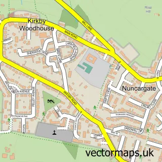
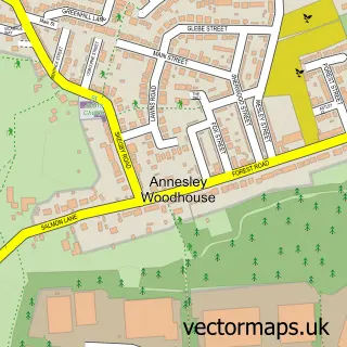
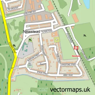
Nearby street map samples around Kirkby-in-Ashfield

More street maps in Nottinghamshire
750 metre map area coverage
Boundary, postcode and point of interest information for the 750m x 750m rectangle centred on this sample map.
Boundaries containing map centre
Constituency: Ashfield Co Const
County: Nottinghamshire County
District: Ashfield District
Icb: NHS Nottingham and Nottinghamshire ICB
Police Force: nottinghamshire
Postcode District: NG17
Postcode Sector: NG17 7
Ward: Greenwood & Summit Ward
Nearby boundaries intersecting sample
Postcode Sector: NG17 8
Ward: Kingsway Ward, Kirkby Cross & Portland Ward
Postcode coverage
POI category counts
Beauty Salon: 16
Doctor: 9
Barber: 8
Gym: 7
Restaurant: 7
Cafe: 6
Hair Salon: 6
Pizza Restaurant: 6
Tattoo And Piercing: 6
Youth Organizations: 6
Sample points of interest
- Anderson & Co. Accountants Ltd.
- Killicks Accountants
- Rainydays Playcentre
- Skirmish Laser Battles
- Jet Joinery Supplies
- S P Stow
- Leisure Time Kirkby-in-Ashfield
- Craftstation
- Barbara Burgess
- Morrisons Daily - Kirby In Ashfield Kingswa, Kirby in Ashfield
- Portland Bodyworks
- Kirkby motor services
Create a larger editable map of Kirkby-in-Ashfield
This sample shows only a 750 metre area. To create a larger map of Kirkby-in-Ashfield, use our map builder to choose your own coverage area, add titles and download editable SVG, PDF and PNG files.
Create a custom map of Kirkby-in-Ashfield