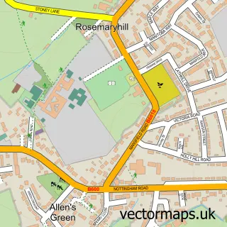
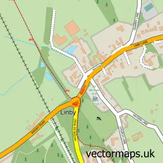
This Annesley Woodhouse street map is a detailed vector street map covering a 750m x 750m area. Select a larger area to create and download your own vector street map of Annesley Woodhouse.
The 750-metre map sample for Annesley Woodhouse covers 398 mapped buildings and approximately 16.3 km of road detail, of which 23 named roads are named. The immediate area includes 1 GP surgery, with 7 within 2 miles, 4 pubs and 7 MOT stations within 2 miles. The wider area around Annesley Woodhouse features 1 tourism point of interest and 5 food and drink venues. To create a larger or custom map of Annesley Woodhouse, the map builder lets you define your own coverage area and download editable SVG, PDF and PNG files.
Create a larger editable map of Annesley Woodhouse
Choose any area you need and generate a high-quality vector map instantly. Perfect for print, planning, design, business and personal use.

This Annesley Woodhouse street map in Nottinghamshire is available as downloadable SVG, PDF and PNG map files, or as a printed map for planning, business, display, education, local information and design work. You can also create a larger custom map area using the map selector.
What this Annesley Woodhouse map sample shows
Annesley Woodhouse lies within Annesley Cp parish, part of Annesley & Kirkby Woodhouse ward in the Ashfield District local authority area. The postcode geography for this area includes the NG postcode area, the NG17 postcode district and the NG17 9 postcode sector. Residents fall under the Nhs Nottingham And Nottinghamshire Integrated Care Board for NHS services.
Local features near Annesley Woodhouse
Within 2 milesAmenities and services in and around Annesley Woodhouse.
Administrative and postcode information for Annesley Woodhouse
Annesley Woodhouse lies within Annesley Cp parish, part of Annesley & Kirkby Woodhouse ward in the Ashfield District local authority area. The postcode geography for this area includes the NG postcode area, the NG17 postcode district and the NG17 9 postcode sector. Residents fall under the Nhs Nottingham And Nottinghamshire Integrated Care Board for NHS services.
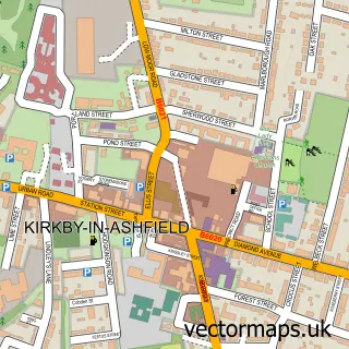
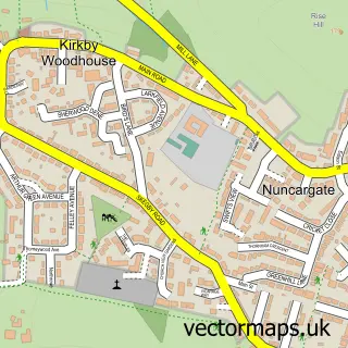
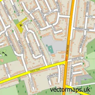
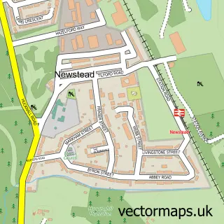
Nearby street map samples around Annesley Woodhouse

More street maps in Nottinghamshire
750 metre map area coverage
Boundary, postcode and point of interest information for the 750m x 750m rectangle centred on this sample map.
Boundaries containing map centre
Constituency: Ashfield Co Const
County: Nottinghamshire County
District: Ashfield District
Icb: NHS Nottingham and Nottinghamshire ICB
Police Force: nottinghamshire
Postcode District: NG17
Postcode Sector: NG17 9
Ward: Annesley & Kirkby Woodhouse Ward
Nearby boundaries intersecting sample
Parish: Annesley CP
Postcode District: NG15
Postcode Sector: NG15 0
Postcode coverage
POI category counts
Pub: 4
Church Cathedral: 3
Doctor: 2
Post Office: 2
Professional Services: 2
Anglican Church: 1
Atms: 1
Automotive Parts And Accessories: 1
Automotive Repair: 1
Barber: 1
Sample points of interest
- St John the Evangelist
- Central England Co-Op - Skegby Road, Annesley Woodhouse
- SMP Europe
- SPS Car Repairs
- The Chop Shop by KK
- Swifty & Co.
- KK Hair Beauty Bar
- RLC Roofing
- Pensions Administration Network
- The Deli Den
- J Newbold Joinery & Shopfitters
- Tying The Knot
Create a larger editable map of Annesley Woodhouse
This sample shows only a 750 metre area. To create a larger map of Annesley Woodhouse, use our map builder to choose your own coverage area, add titles and download editable SVG, PDF and PNG files.
Create a custom map of Annesley Woodhouse