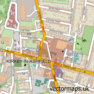
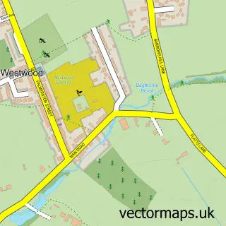
This New Selston street map is a detailed vector street map covering a 750m x 750m area. Select a larger area to create and download your own vector street map of New Selston.
The 750-metre map sample for New Selston covers 123 mapped buildings and approximately 5.8 km of road detail, of which 5 named roads are named. The immediate area includes 1 GP surgery within 2 miles, 2 pubs and 7 MOT stations within 2 miles. The wider area around New Selston features 3 food and drink venues and 1 hotel. To create a larger or custom map of New Selston, the map builder lets you define your own coverage area and download editable SVG, PDF and PNG files.
Create a larger editable map of New Selston
Choose any area you need and generate a high-quality vector map instantly. Perfect for print, planning, design, business and personal use.

This New Selston street map in Nottinghamshire is available as downloadable SVG, PDF and PNG map files, or as a printed map for planning, business, display, education, local information and design work. You can also create a larger custom map area using the map selector.
What this New Selston map sample shows
New Selston lies within Pinxton Cp parish, part of Pinxton ward in the Bolsover District local authority area. The postcode geography for this area includes the NG postcode area, the NG16 postcode district and the NG16 6 postcode sector. Residents fall under the Nhs Derby And Derbyshire Integrated Care Board for NHS services.
Local features near New Selston
Within 2 milesAmenities and services in and around New Selston.
Administrative and postcode information for New Selston
New Selston lies within Pinxton Cp parish, part of Pinxton ward in the Bolsover District local authority area. The postcode geography for this area includes the NG postcode area, the NG16 postcode district and the NG16 6 postcode sector. Residents fall under the Nhs Derby And Derbyshire Integrated Care Board for NHS services.
Nearby street map samples around New Selston


More street maps in Nottinghamshire
750 metre map area coverage
Boundary, postcode and point of interest information for the 750m x 750m rectangle centred on this sample map.
Boundaries containing map centre
Constituency: Ashfield Co Const
County: Nottinghamshire County
District: Ashfield District
Icb: NHS Nottingham and Nottinghamshire ICB
Parish: Selston CP
Police Force: nottinghamshire
Postcode District: NG16
Postcode Sector: NG16 6
Ward: Selston Ward
Nearby boundaries intersecting sample
Constituency: Bolsover Co Const
County: Derbyshire County
District: Bolsover District
Icb: NHS Derby and Derbyshire ICB
Parish: Pinxton CP
Police Force: derbyshire
Ward: Pinxton Ward
Postcode coverage
POI category counts
Business Manufacturing And Supply: 4
Automotive Repair: 2
Building Supply Store: 2
Garbage Collection Service: 2
Metal Fabricator: 2
Pub: 2
Retail: 2
Arts And Entertainment: 1
Auto Upholstery: 1
Car Rental Agency: 1
Sample points of interest
- The Vintage Ride Company
- Whalin Upholstery
- Dils Bodywork Specialist EM
- Mobile mechanics
- Kingfisher Louvre Systems
- Lafarge Readymix
- Building Product Design
- Kingsmill Industries UK
- London Porticos Ltd
- Neville Precision Engineering
- Firow
- The Local Car Wash
Create a larger editable map of New Selston
This sample shows only a 750 metre area. To create a larger map of New Selston, use our map builder to choose your own coverage area, add titles and download editable SVG, PDF and PNG files.
Create a custom map of New Selston