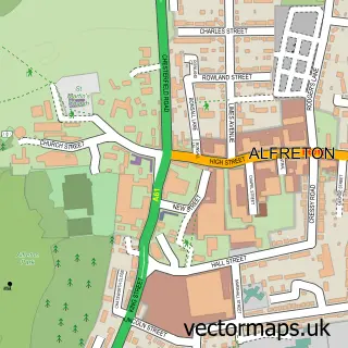
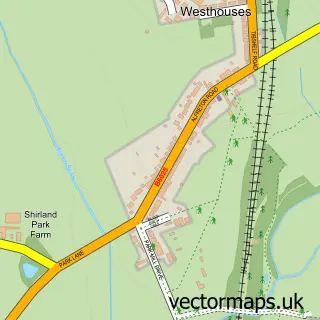
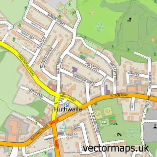
This South Normanton street map is a detailed vector street map covering a 750m x 750m area. Select a larger area to create and download your own vector street map of South Normanton.
The 750-metre map sample for South Normanton covers 631 mapped buildings and approximately 27.5 km of road detail, of which 43 named roads are named. The immediate area includes 3 schools, 1 GP surgery, 7 pubs and 1 MOT station, with 11 within 2 miles. The wider area around South Normanton features 12 food and drink venues. To create a larger or custom map of South Normanton, the map builder lets you define your own coverage area and download editable SVG, PDF and PNG files.
Create a larger editable map of South Normanton
Choose any area you need and generate a high-quality vector map instantly. Perfect for print, planning, design, business and personal use.

This South Normanton street map in Derbyshire is available as downloadable SVG, PDF and PNG map files, or as a printed map for planning, business, display, education, local information and design work. You can also create a larger custom map area using the map selector.
What this South Normanton map sample shows
South Normanton lies within South Normanton Cp parish, part of South Normanton East ward in the Bolsover District local authority area. The postcode geography for this area includes the DE postcode area, the DE55 postcode district and the DE55 2 postcode sector. Residents fall under the Nhs Derby And Derbyshire Integrated Care Board for NHS services.
Local features near South Normanton
Within 2 milesAmenities and services in and around South Normanton.
Administrative and postcode information for South Normanton
South Normanton lies within South Normanton Cp parish, part of South Normanton East ward in the Bolsover District local authority area. The postcode geography for this area includes the DE postcode area, the DE55 postcode district and the DE55 2 postcode sector. Residents fall under the Nhs Derby And Derbyshire Integrated Care Board for NHS services.
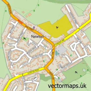
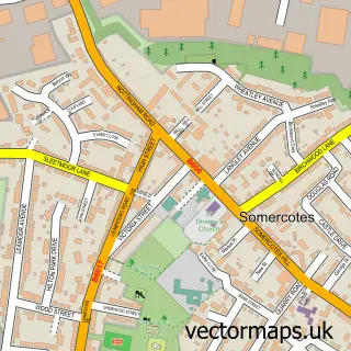
Nearby street map samples around South Normanton

More street maps in Derbyshire
750 metre map area coverage
Boundary, postcode and point of interest information for the 750m x 750m rectangle centred on this sample map.
Boundaries containing map centre
Constituency: Bolsover Co Const
County: Derbyshire County
District: Bolsover District
Icb: NHS Derby and Derbyshire ICB
Parish: South Normanton CP
Police Force: derbyshire
Postcode District: DE55
Postcode Sector: DE55 2
Ward: South Normanton East Ward
Nearby boundaries intersecting sample
Ward: South Normanton West Ward
Postcode coverage
POI category counts
Pub: 7
Church Cathedral: 4
Convenience Store: 4
Flowers And Gifts Shop: 4
Financial Service: 3
Printing Services: 3
Professional Services: 3
Atms: 2
Building Supply Store: 2
Cafe: 2
Sample points of interest
- Hatfield & Co.
- South Normanton Adult Education Centre
- St Michael & All Angels South Normanton
- Derbyshire Koi & Aquatics
- ATM (Post Office)
- The Cooperative Food (BF) South Normanton, South Normanton
- John Watson & Sons Electrical
- Mustard Services
- Tile Town Warehouse
- The Bakehouse
- Razor Kingz
- Hairdayzzz
Create a larger editable map of South Normanton
This sample shows only a 750 metre area. To create a larger map of South Normanton, use our map builder to choose your own coverage area, add titles and download editable SVG, PDF and PNG files.
Create a custom map of South Normanton