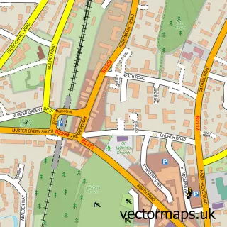
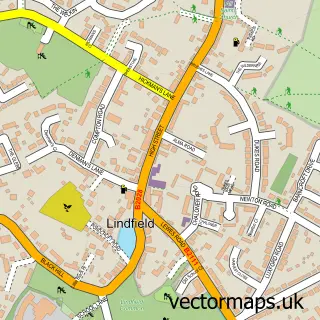
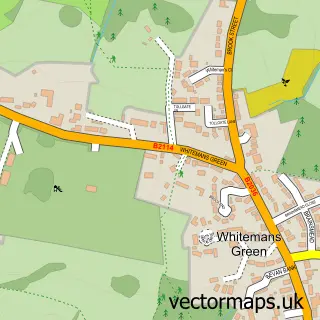
This Ardingly street map is a detailed vector street map covering a 750m x 750m area. Select a larger area to create and download your own vector street map of Ardingly.
The 750-metre map sample for Ardingly covers 273 mapped buildings and approximately 8.9 km of road detail, of which 17 named roads are named. The immediate area includes 1 pub. The wider area around Ardingly features 3 food and drink venues. To create a larger or custom map of Ardingly, the map builder lets you define your own coverage area and download editable SVG, PDF and PNG files.
Create a larger editable map of Ardingly
Choose any area you need and generate a high-quality vector map instantly. Perfect for print, planning, design, business and personal use.

This Ardingly street map in West Sussex is available as downloadable SVG, PDF and PNG map files, or as a printed map for planning, business, display, education, local information and design work. You can also create a larger custom map area using the map selector.
What this Ardingly map sample shows
Ardingly lies within Ardingly Cp parish, part of Ardingly And Balcombe ward in the Mid Sussex District local authority area. The postcode geography for this area includes the RH postcode area, the RH17 postcode district and the RH17 6 postcode sector. Residents fall under the Nhs Sussex Integrated Care Board for NHS services.
Local features near Ardingly
Within 2 milesAmenities and services in and around Ardingly.
Administrative and postcode information for Ardingly
The local authority covering Ardingly is Mid Sussex District, within the county of West Sussex. The settlement lies within Ardingly And Balcombe ward and Ardingly Cp civil parish. The RH17 postcode district and RH17 6 postcode sector serve the immediate area. NHS provision in the area is delivered through University Hospitals Sussex Nhs Foundation Trust.
Nearby street map samples around Ardingly

More street maps in West Sussex
750 metre map area coverage
Boundary, postcode and point of interest information for the 750m x 750m rectangle centred on this sample map.
Boundaries containing map centre
Constituency: East Grinstead and Uckfield Co Const
County: West Sussex County
District: Mid Sussex District
Icb: NHS Surrey and Sussex ICB
Parish: Ardingly CP
Police Force: sussex
Postcode District: RH17
Postcode Sector: RH17 6
Ward: Ardingly, Balcombe & Turners Hill Ward
Nearby boundaries intersecting sample
No additional intersecting boundaries found.
Postcode coverage
POI category counts
Professional Services: 4
Bakery: 2
Charity Organization: 2
Community Services Non Profits: 2
Art Gallery: 1
Automotive Services And Repair: 1
Bar: 1
Books Mags Music And Video: 1
Bowling Alley: 1
Cafe: 1
Sample points of interest
- Artyfect
- Cale Systems
- Ardingly bakery
- Fellows Bakery Ardingly
- Oak Inn
- Post Office-Ardingly
- Avenue Decking Swimming Pools & Spa's
- Ardingly Café
- Kelmsley Catering
- Imara Uganda Education Fund
- Imara Uganda Education Fund
- Ardingly Hapstead Hall
Create a larger editable map of Ardingly
This sample shows only a 750 metre area. To create a larger map of Ardingly, use our map builder to choose your own coverage area, add titles and download editable SVG, PDF and PNG files.
Create a custom map of Ardingly