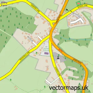
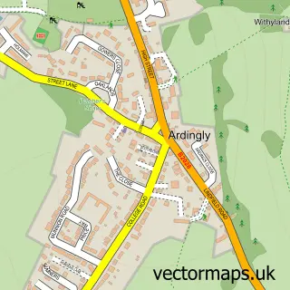
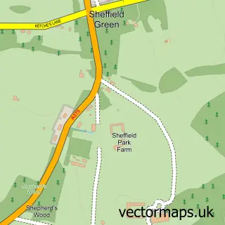
This Horsted Keynes street map is a detailed vector street map covering a 750m x 750m area. Select a larger area to create and download your own vector street map of Horsted Keynes.
The 750-metre map sample for Horsted Keynes covers 301 mapped buildings and approximately 12.3 km of road detail, of which 19 named roads are named. The immediate area includes 3 pubs. The wider area around Horsted Keynes features 1 tourism point of interest, 3 food and drink venues and 1 hotel. To create a larger or custom map of Horsted Keynes, the map builder lets you define your own coverage area and download editable SVG, PDF and PNG files.
Create a larger editable map of Horsted Keynes
Choose any area you need and generate a high-quality vector map instantly. Perfect for print, planning, design, business and personal use.

This Horsted Keynes street map in West Sussex is available as downloadable SVG, PDF and PNG map files, or as a printed map for planning, business, display, education, local information and design work. You can also create a larger custom map area using the map selector.
What this Horsted Keynes map sample shows
Horsted Keynes lies within Horsted Keynes Cp parish, part of High Weald ward in the Mid Sussex District local authority area. The postcode geography for this area includes the RH postcode area, the RH17 postcode district and the RH17 7 postcode sector. Residents fall under the Nhs Sussex Integrated Care Board for NHS services.
Local features near Horsted Keynes
Within 2 milesAmenities and services in and around Horsted Keynes.
Administrative and postcode information for Horsted Keynes
The local authority covering Horsted Keynes is Mid Sussex District, within the county of West Sussex. The settlement lies within High Weald ward and Horsted Keynes Cp civil parish. The RH17 postcode district and RH17 7 postcode sector serve the immediate area. NHS provision in the area is delivered through University Hospitals Sussex Nhs Foundation Trust.
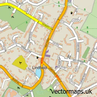
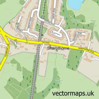
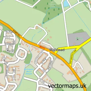
Nearby street map samples around Horsted Keynes

More street maps in West Sussex
750 metre map area coverage
Boundary, postcode and point of interest information for the 750m x 750m rectangle centred on this sample map.
Boundaries containing map centre
Constituency: East Grinstead and Uckfield Co Const
County: West Sussex County
District: Mid Sussex District
Icb: NHS Surrey and Sussex ICB
Parish: Horsted Keynes CP
Police Force: sussex
Postcode District: RH17
Postcode Sector: RH17 7
Ward: Lindfield Rural & High Weald Ward
Nearby boundaries intersecting sample
No additional intersecting boundaries found.
Postcode coverage
POI category counts
Pub: 3
Amusement Park: 1
Architect: 1
Bakery: 1
Building Supply Store: 1
Caterer: 1
Cricket Ground: 1
Environmental Conservation Organization: 1
Hotel: 1
Landscaping: 1
Sample points of interest
- Tremaines Riding Stables
- Andrew Paine Architecture
- Flour and Bloom by Sue
- Horstead Garden Services
- Loaf
- Horsted Keynes Cricket Club
- Temple Group
- Victoria Inns
- Greyhound Tree and Garden Services
- Burghurst Lodge
- The Royal British Legion
- Horsted Keynes Post Office
Create a larger editable map of Horsted Keynes
This sample shows only a 750 metre area. To create a larger map of Horsted Keynes, use our map builder to choose your own coverage area, add titles and download editable SVG, PDF and PNG files.
Create a custom map of Horsted Keynes