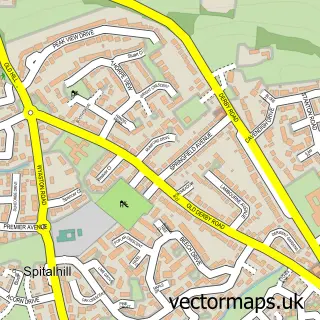
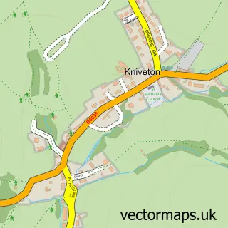
This Ashbourne street map is a detailed vector street map covering a 750m x 750m area. Select a larger area to create and download your own vector street map of Ashbourne.
The 750-metre map sample for Ashbourne covers 340 mapped buildings and approximately 25.2 km of road detail, of which 41 named roads are named. The immediate area includes 1 school, 2 GP surgeries within 2 miles, 17 pubs and 1 MOT station, with 5 within 2 miles. The wider area around Ashbourne features 10 tourism points of interest, 34 food and drink venues and 7 hotels. To create a larger or custom map of Ashbourne, the map builder lets you define your own coverage area and download editable SVG, PDF and PNG files.
Create a larger editable map of Ashbourne
Choose any area you need and generate a high-quality vector map instantly. Perfect for print, planning, design, business and personal use.

This Ashbourne street map in Derbyshire is available as downloadable SVG, PDF and PNG map files, or as a printed map for planning, business, display, education, local information and design work. You can also create a larger custom map area using the map selector.
What this Ashbourne map sample shows
Ashbourne lies within Ashbourne Cp parish, part of Ashbourne North ward in the Derbyshire Dales District local authority area. The postcode geography for this area includes the DE postcode area, the DE6 postcode district and the DE6 1 postcode sector. Residents fall under the Nhs Derby And Derbyshire Integrated Care Board for NHS services.
Local features near Ashbourne
Within 2 milesAmenities and services in and around Ashbourne.
Administrative and postcode information for Ashbourne
The local authority covering Ashbourne is Derbyshire Dales District, within the county of Derbyshire. The settlement lies within Ashbourne North ward and Ashbourne Cp civil parish. The DE6 postcode district and DE6 1 postcode sector serve the immediate area. NHS provision in the area is delivered through University Hospitals Of Derby And Burton Nhs Foundation Trust.
Nearby street map samples around Ashbourne

More street maps in Derbyshire
750 metre map area coverage
Boundary, postcode and point of interest information for the 750m x 750m rectangle centred on this sample map.
Boundaries containing map centre
Constituency: Derbyshire Dales Co Const
County: Derbyshire County
District: Derbyshire Dales District
Icb: NHS Derby and Derbyshire ICB
Parish: Ashbourne CP
Police Force: derbyshire
Postcode District: DE6
Postcode Sector: DE6 1
Ward: Ashbourne North Ward
Nearby boundaries intersecting sample
Parish: Offcote and Underwood CP
Postcode Sector: DE6 2
Ward: Ashbourne South Ward
Postcode coverage
POI category counts
Hair Salon: 17
Pub: 17
Clothing Store: 16
Flowers And Gifts Shop: 10
Antique Store: 9
Beauty Salon: 9
Cafe: 8
Jewelry Store: 8
Bank Credit Union: 7
Hotel: 7
Sample points of interest
- Bradley Accounting Plus Ltd
- Coates and Partners
- Libra Business Essentials Ltd
- PKF Smith Cooper | Accountants Ashbourne
- Peak Management Associates Ltd.
- Ashbourne Adult Community Education Centre
- SMQ Media P R & Services
- Word of
- Ashbourne Ambulance Station
- Alders Farm Retirement Livery
- St John's
- St Oswald's Church, Ashbourne, Derbyshire
Create a larger editable map of Ashbourne
This sample shows only a 750 metre area. To create a larger map of Ashbourne, use our map builder to choose your own coverage area, add titles and download editable SVG, PDF and PNG files.
Create a custom map of Ashbourne