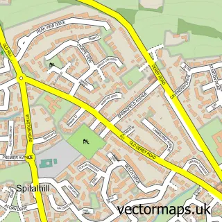
This Hangingbridge street map is a detailed vector street map covering a 750m x 750m area. Select a larger area to create and download your own vector street map of Hangingbridge.
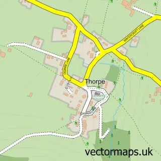
The 750-metre map sample for Hangingbridge covers 58 mapped buildings and approximately 7.8 km of road detail, of which 4 named roads are named. The immediate area includes 2 GP surgeries within 2 miles and 1 MOT station, with 5 within 2 miles. The wider area around Hangingbridge features 1 tourism point of interest, 1 hotel and 1 campsite within 2 miles. To create a larger or custom map of Hangingbridge, the map builder lets you define your own coverage area and download editable SVG, PDF and PNG files.
Create a larger editable map of Hangingbridge
Choose any area you need and generate a high-quality vector map instantly. Perfect for print, planning, design, business and personal use.

This Hangingbridge street map in Derbyshire is available as downloadable SVG, PDF and PNG map files, or as a printed map for planning, business, display, education, local information and design work. You can also create a larger custom map area using the map selector.
What this Hangingbridge map sample shows
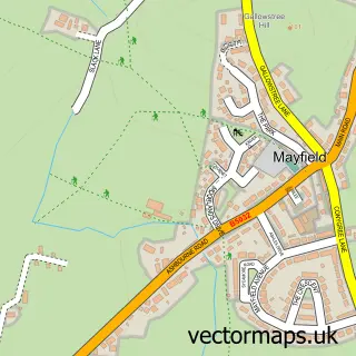
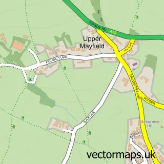
Hangingbridge lies within Mayfield Cp parish, part of Weaver ward in the East Staffordshire District (B) local authority area. The postcode geography for this area includes the DE postcode area, the DE6 postcode district and the DE6 2 postcode sector. Residents fall under the Nhs Staffordshire And Stoke-On-Trent Integrated Care Board for NHS services.
Local features near Hangingbridge
Within 2 milesAmenities and services in and around Hangingbridge.
Administrative and postcode information for Hangingbridge
The local authority covering Hangingbridge is East Staffordshire District (B), within the county of Derbyshire. The settlement lies within Weaver ward and Mayfield Cp civil parish. The DE6 postcode district and DE6 2 postcode sector serve the immediate area. NHS provision in the area is delivered through University Hospitals Of Derby And Burton Nhs Foundation Trust.
Nearby street map samples around Hangingbridge

More street maps in Derbyshire
750 metre map area coverage
Boundary, postcode and point of interest information for the 750m x 750m rectangle centred on this sample map.
Boundaries containing map centre
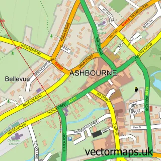
Constituency: Derbyshire Dales Co Const
County: Derbyshire County
District: Derbyshire Dales District
Icb: NHS Derby and Derbyshire ICB
Parish: Clifton and Compton CP
Police Force: derbyshire
Postcode District: DE6
Postcode Sector: DE6 2
Ward: Ashbourne South Ward
Nearby boundaries intersecting sample
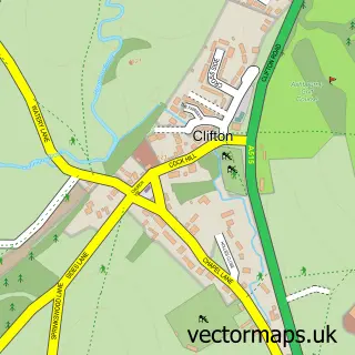
Parish: Offcote and Underwood CP
Ward: Ashbourne North Ward
Postcode coverage
POI category counts
Gas Station: 3
Bed And Breakfast: 2
Shipping Center: 2
Beauty Salon: 1
Car Dealer: 1
Convenience Store: 1
Garbage Collection Service: 1
Hotel: 1
Landmark And Historical Building: 1
Laundry Services: 1
Sample points of interest
- The Haven : Beauty
- Lilacs – Guest House Ashbourne
- The Lilacs
- F W Harrison Commercials
- Duke of York Filling station-BP
- H W Martins
- BP
- DUKE OF YORK FILLING STATION
- Gulf
- Stone Cottage
- Mayfield
- Wash.ME - Duke Of York Service Station a
Create a larger editable map of Hangingbridge
This sample shows only a 750 metre area. To create a larger map of Hangingbridge, use our map builder to choose your own coverage area, add titles and download editable SVG, PDF and PNG files.
Create a custom map of Hangingbridge