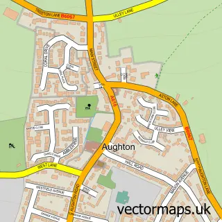
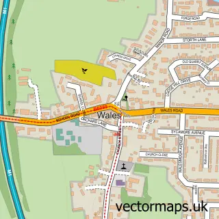
This Aston street map is a detailed vector street map covering a 750m x 750m area. Select a larger area to create and download your own vector street map of Aston.
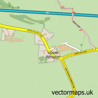
The 750-metre map sample for Aston covers 577 mapped buildings and approximately 29.3 km of road detail, of which 44 named roads are named. The immediate area includes 1 GP surgery within 2 miles and 9 MOT stations within 2 miles. The wider area around Aston features 3 food and drink venues and 3 hotels. To create a larger or custom map of Aston, the map builder lets you define your own coverage area and download editable SVG, PDF and PNG files.
Create a larger editable map of Aston
Choose any area you need and generate a high-quality vector map instantly. Perfect for print, planning, design, business and personal use.

This Aston street map in South Yorkshire is available as downloadable SVG, PDF and PNG map files, or as a printed map for planning, business, display, education, local information and design work. You can also create a larger custom map area using the map selector.
What this Aston map sample shows
Aston lies within Aston Cum Aughton Cp parish, part of Holderness ward in the Rotherham District (B) local authority area. The postcode geography for this area includes the S postcode area, the S26 postcode district and the S26 2 postcode sector. Residents fall under the Nhs South Yorkshire Integrated Care Board for NHS services.
Local features near Aston
Within 2 milesAmenities and services in and around Aston.
Administrative and postcode information for Aston
Aston lies within Aston Cum Aughton Cp parish, part of Holderness ward in the Rotherham District (B) local authority area. The postcode geography for this area includes the S postcode area, the S26 postcode district and the S26 2 postcode sector. Residents fall under the Nhs South Yorkshire Integrated Care Board for NHS services.
Nearby street map samples around Aston

More street maps in South Yorkshire
750 metre map area coverage
Boundary, postcode and point of interest information for the 750m x 750m rectangle centred on this sample map.
Boundaries containing map centre
Constituency: Rother Valley Co Const
District: Rotherham District (B)
Icb: NHS South Yorkshire ICB
Parish: Aston cum Aughton CP
Police Force: south yorkshire
Postcode District: S26
Postcode Sector: S26 2
Ward: Aston & Todwick Ward
Nearby boundaries intersecting sample
No additional intersecting boundaries found.
Postcode coverage
POI category counts
Beauty Salon: 4
Driving School: 3
Hotel: 3
Bar: 2
Cafe: 2
Convenience Store: 2
Gas Station: 2
Grocery Store: 2
Package Locker: 2
Alternative Medicine: 1
Sample points of interest
- Ruth Major Hypnotherapist
- Aston All Saints
- Asda (C) Aston - Worksop Road PFS, Aston
- Ocean Airport - Cabo Verde
- Silvas- Beach House
- Hair by Jodie
- Hairby.JennyDucker
- Kaleido Aesthetics
- The Hair Studio
- Classico bici
- Aston Roofing
- Aston Cafe
Create a larger editable map of Aston
This sample shows only a 750 metre area. To create a larger map of Aston, use our map builder to choose your own coverage area, add titles and download editable SVG, PDF and PNG files.
Create a custom map of Aston