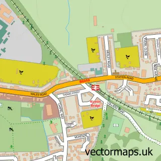
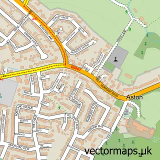
This Killamarsh street map is a detailed vector street map covering a 750m x 750m area. Select a larger area to create and download your own vector street map of Killamarsh.
The 750-metre map sample for Killamarsh covers 567 mapped buildings and approximately 23.5 km of road detail, of which 44 named roads are named. The immediate area includes 1 school, 1 GP surgery, with 5 within 2 miles, 1 pub and 14 MOT stations within 2 miles. The wider area around Killamarsh features 2 tourism points of interest and 12 food and drink venues. To create a larger or custom map of Killamarsh, the map builder lets you define your own coverage area and download editable SVG, PDF and PNG files.
Create a larger editable map of Killamarsh
Choose any area you need and generate a high-quality vector map instantly. Perfect for print, planning, design, business and personal use.

This Killamarsh street map in Derbyshire is available as downloadable SVG, PDF and PNG map files, or as a printed map for planning, business, display, education, local information and design work. You can also create a larger custom map area using the map selector.
What this Killamarsh map sample shows
Killamarsh lies within Killamarsh Cp parish, part of Killamarsh East ward in the North East Derbyshire District local authority area. The postcode geography for this area includes the S postcode area, the S21 postcode district and the S21 1 postcode sector. Residents fall under the Nhs Derby And Derbyshire Integrated Care Board for NHS services.
Local features near Killamarsh
Within 2 milesAmenities and services in and around Killamarsh.
Administrative and postcode information for Killamarsh
The local authority covering Killamarsh is North East Derbyshire District, within the county of Derbyshire. The settlement lies within Killamarsh East ward and Killamarsh Cp civil parish. The S21 postcode district and S21 1 postcode sector serve the immediate area. NHS provision in the area is delivered through Chesterfield Royal Hospital Nhs Foundation Trust.
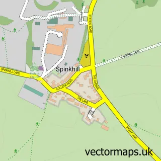
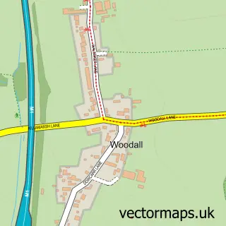
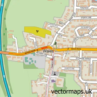
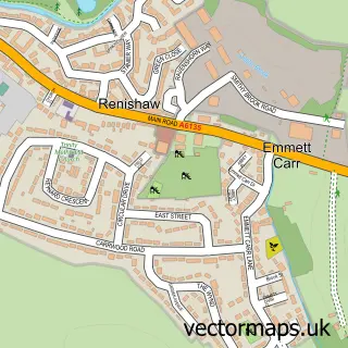
Nearby street map samples around Killamarsh

More street maps in Derbyshire
750 metre map area coverage
Boundary, postcode and point of interest information for the 750m x 750m rectangle centred on this sample map.
Boundaries containing map centre
Constituency: North East Derbyshire Co Const
County: Derbyshire County
District: North East Derbyshire District
Icb: NHS Derby and Derbyshire ICB
Parish: Killamarsh CP
Police Force: derbyshire
Postcode District: S21
Postcode Sector: S21 1
Ward: Killamarsh West Ward
Nearby boundaries intersecting sample
Constituency: Rother Valley Co Const
District: Rotherham District (B)
Icb: NHS South Yorkshire ICB
Parish: Wales CP
Police Force: south yorkshire
Postcode District: S26
Postcode Sector: S26 5
Ward: Killamarsh East Ward, Wales Ward
Postcode coverage
POI category counts
Beauty Salon: 11
Beauty And Spa: 5
Funeral Services And Cemeteries: 5
Hair Salon: 5
Restaurant: 5
Barber: 4
Cafe: 4
Building Supply Store: 3
Carpet Store: 3
Church Cathedral: 3
Sample points of interest
- Doris N Daves Pad
- Copytec
- Its About Time
- Audio Vision
- Picture Parade
- Keith Fish teaching the Bob Ross Oil Painting Technique
- Lodge Care Centre
- ATM (Post Office)
- B&M Killamarsh , Killamarsh
- ADS Automotive Detailing Service
- Lifestyle Mortgage Centres
- The Tech Booth
Create a larger editable map of Killamarsh
This sample shows only a 750 metre area. To create a larger map of Killamarsh, use our map builder to choose your own coverage area, add titles and download editable SVG, PDF and PNG files.
Create a custom map of Killamarsh