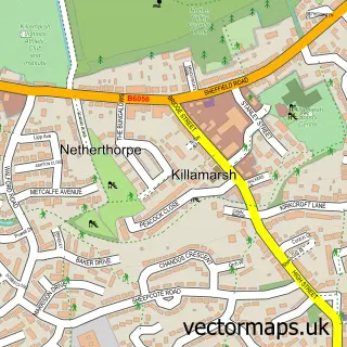
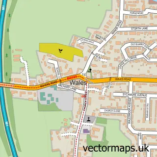
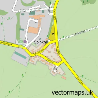
This Harthill street map is a detailed vector street map covering a 750m x 750m area. Select a larger area to create and download your own vector street map of Harthill.
The 750-metre map sample for Harthill covers 385 mapped buildings and approximately 17.5 km of road detail, of which 28 named roads are named. The immediate area includes 1 school, 1 GP surgery within 2 miles, 2 pubs and 5 MOT stations within 2 miles. The wider area around Harthill features 2 tourism points of interest and 2 food and drink venues. To create a larger or custom map of Harthill, the map builder lets you define your own coverage area and download editable SVG, PDF and PNG files.
Create a larger editable map of Harthill
Choose any area you need and generate a high-quality vector map instantly. Perfect for print, planning, design, business and personal use.

This Harthill street map in South Yorkshire is available as downloadable SVG, PDF and PNG map files, or as a printed map for planning, business, display, education, local information and design work. You can also create a larger custom map area using the map selector.
What this Harthill map sample shows
Harthill lies within Harthill With Woodall Cp parish, part of Wales ward in the Rotherham District (B) local authority area. The postcode geography for this area includes the S postcode area, the S26 postcode district and the S26 7 postcode sector. Residents fall under the Nhs South Yorkshire Integrated Care Board for NHS services.
Local features near Harthill
Within 2 milesAmenities and services in and around Harthill.
Administrative and postcode information for Harthill
The local authority covering Harthill is Rotherham District (B), within the county of South Yorkshire. The settlement lies within Wales ward and Harthill With Woodall Cp civil parish. The S26 postcode district and S26 7 postcode sector serve the immediate area. NHS provision in the area is delivered through The Rotherham Nhs Foundation Trust.
Nearby street map samples around Harthill

More street maps in South Yorkshire
750 metre map area coverage
Boundary, postcode and point of interest information for the 750m x 750m rectangle centred on this sample map.
Boundaries containing map centre
Constituency: Rother Valley Co Const
District: Rotherham District (B)
Icb: NHS South Yorkshire ICB
Parish: Harthill with Woodall CP
Police Force: south yorkshire
Postcode District: S26
Postcode Sector: S26 7
Ward: Wales Ward
Nearby boundaries intersecting sample
No additional intersecting boundaries found.
Postcode coverage
POI category counts
Bakery: 2
Carpenter: 2
Child Care And Day Care: 2
Church Cathedral: 2
Elementary School: 2
Home Health Care: 2
Hvac Services: 2
Pub: 2
Anglican Church: 1
Antique Store: 1
Sample points of interest
- All Hallows’ Harthill with Woodall
- The Calvie Gallery Harthill
- Maison Frais
- Harry Roper
- Harthill Garage
- Chocomoo Cakes
- Harthill Bakery
- Razors Barbers
- The Hairdoctor Sheffield
- No. 69 Hair & Beauty
- Harthill Fish & Chips
- Export Eze
Create a larger editable map of Harthill
This sample shows only a 750 metre area. To create a larger map of Harthill, use our map builder to choose your own coverage area, add titles and download editable SVG, PDF and PNG files.
Create a custom map of Harthill