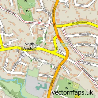
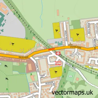
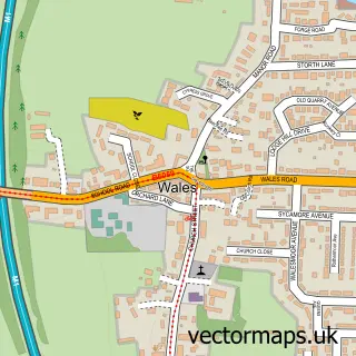
This South Anston street map is a detailed vector street map covering a 750m x 750m area. Select a larger area to create and download your own vector street map of South Anston.
The 750-metre map sample for South Anston covers 608 mapped buildings and approximately 32.3 km of road detail, of which 42 named roads are named. The immediate area includes 1 school, 1 GP surgery within 2 miles, 3 pubs and 7 MOT stations within 2 miles. The wider area around South Anston features 5 food and drink venues. To create a larger or custom map of South Anston, the map builder lets you define your own coverage area and download editable SVG, PDF and PNG files.
Create a larger editable map of South Anston
Choose any area you need and generate a high-quality vector map instantly. Perfect for print, planning, design, business and personal use.

This South Anston street map in South Yorkshire is available as downloadable SVG, PDF and PNG map files, or as a printed map for planning, business, display, education, local information and design work. You can also create a larger custom map area using the map selector.
What this South Anston map sample shows
South Anston lies within North And South Anston Cp parish, part of Anston And Woodsetts ward in the Rotherham District (B) local authority area. The postcode geography for this area includes the S postcode area, the S25 postcode district and the S25 5 postcode sector. Residents fall under the Nhs South Yorkshire Integrated Care Board for NHS services.
Local features near South Anston
Within 2 milesAmenities and services in and around South Anston.
Administrative and postcode information for South Anston
The local authority covering South Anston is Rotherham District (B), within the county of South Yorkshire. The settlement lies within Anston And Woodsetts ward and North And South Anston Cp civil parish. The S25 postcode district and S25 5 postcode sector serve the immediate area. NHS provision in the area is delivered through The Rotherham Nhs Foundation Trust.
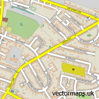
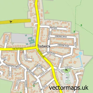
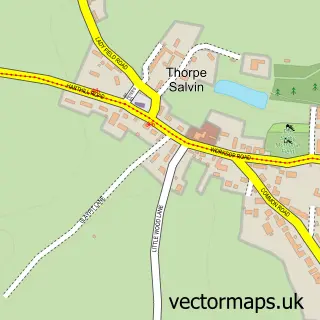
Nearby street map samples around South Anston

More street maps in South Yorkshire
750 metre map area coverage
Boundary, postcode and point of interest information for the 750m x 750m rectangle centred on this sample map.
Boundaries containing map centre
Constituency: Rother Valley Co Const
District: Rotherham District (B)
Icb: NHS South Yorkshire ICB
Parish: North and South Anston CP
Police Force: south yorkshire
Postcode District: S25
Postcode Sector: S25 5
Ward: Anston & Woodsetts Ward
Nearby boundaries intersecting sample
Postcode Sector: S25 4
Postcode coverage
POI category counts
Professional Services: 6
Beauty Salon: 3
Convenience Store: 3
Pub: 3
Advertising Agency: 2
Bakery: 2
Cafe: 2
Church Cathedral: 2
Gas Station: 2
Kids Recreation And Party: 2
Sample points of interest
- Silkin Tan Creative Design
- Vision Launch
- Euro Garages South Anston
- Wainwrights Service Station
- Cakes By Nancy
- Rubylicious Cakes and Bakes
- Mint Nail and Beauty
- Innovations in Hair at South Anston
- Orchid Beauty
- Relax Beauty and Tanning
- Confetti Classic Cars
- DPM Beskspoke Woodcraft
Create a larger editable map of South Anston
This sample shows only a 750 metre area. To create a larger map of South Anston, use our map builder to choose your own coverage area, add titles and download editable SVG, PDF and PNG files.
Create a custom map of South Anston