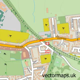
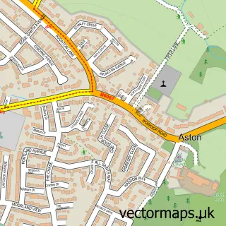
This Wales street map is a detailed vector street map covering a 750m x 750m area. Select a larger area to create and download your own vector street map of Wales.
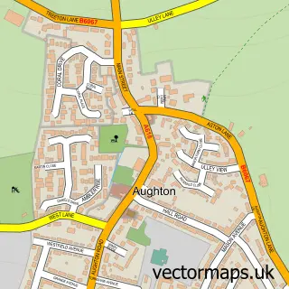
The 750-metre map sample for Wales covers 409 mapped buildings and approximately 22.9 km of road detail, of which 24 named roads are named. The immediate area includes 1 school, 2 GP surgeries within 2 miles, 2 pubs and 1 MOT station, with 9 within 2 miles. The wider area around Wales features 3 tourism points of interest and 2 food and drink venues. To create a larger or custom map of Wales, the map builder lets you define your own coverage area and download editable SVG, PDF and PNG files.
Create a larger editable map of Wales
Choose any area you need and generate a high-quality vector map instantly. Perfect for print, planning, design, business and personal use.

This Wales street map in South Yorkshire is available as downloadable SVG, PDF and PNG map files, or as a printed map for planning, business, display, education, local information and design work. You can also create a larger custom map area using the map selector.
What this Wales map sample shows
Wales lies within Wales Cp parish, part of Wales ward in the Rotherham District (B) local authority area. The postcode geography for this area includes the S postcode area, the S26 postcode district and the S26 5 postcode sector. Residents fall under the Nhs South Yorkshire Integrated Care Board for NHS services.
Local features near Wales
Within 2 milesAmenities and services in and around Wales.
Administrative and postcode information for Wales
Wales lies within Wales Cp parish, part of Wales ward in the Rotherham District (B) local authority area. The postcode geography for this area includes the S postcode area, the S26 postcode district and the S26 5 postcode sector. Residents fall under the Nhs South Yorkshire Integrated Care Board for NHS services.
Nearby street map samples around Wales

More street maps in South Yorkshire
750 metre map area coverage
Boundary, postcode and point of interest information for the 750m x 750m rectangle centred on this sample map.
Boundaries containing map centre
Constituency: Rother Valley Co Const
District: Rotherham District (B)
Icb: NHS South Yorkshire ICB
Parish: Wales CP
Police Force: south yorkshire
Postcode District: S26
Postcode Sector: S26 5
Ward: Wales Ward
Nearby boundaries intersecting sample
No additional intersecting boundaries found.
Postcode coverage
POI category counts
Beauty Salon: 3
Automotive Repair: 2
Church Cathedral: 2
Language School: 2
Park: 2
Pet Services: 2
Pharmacy: 2
Pub: 2
Anglican Church: 1
Beauty And Spa: 1
Sample points of interest
- St John the Baptist, Wales
- RJC Autos Ltd
- Whitelea Garage
- Ruby's Aesthetics
- Designers
- Heidi sharpe at designers
- Locks of Luxe
- Prestige Window Systems
- Little Explorers Day Care Nursery
- Kiveton Methodist Church
- St John The Baptist Church
- Wales Junior & Infant School
Create a larger editable map of Wales
This sample shows only a 750 metre area. To create a larger map of Wales, use our map builder to choose your own coverage area, add titles and download editable SVG, PDF and PNG files.
Create a custom map of Wales