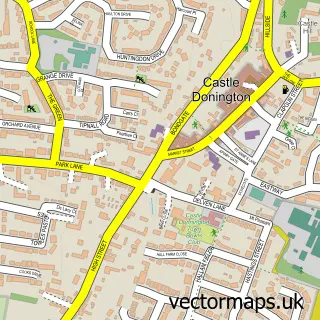
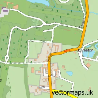
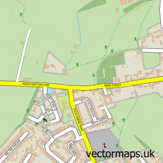
This Aston-on-Trent street map is a detailed vector street map covering a 750m x 750m area. Select a larger area to create and download your own vector street map of Aston-on-Trent.
The 750-metre map sample for Aston-on-Trent covers 349 mapped buildings and approximately 18.0 km of road detail, of which 29 named roads are named. The immediate area includes 2 schools, 3 pubs and 1 MOT station within 2 miles. The wider area around Aston-on-Trent features 4 food and drink venues. To create a larger or custom map of Aston-on-Trent, the map builder lets you define your own coverage area and download editable SVG, PDF and PNG files.
Create a larger editable map of Aston-on-Trent
Choose any area you need and generate a high-quality vector map instantly. Perfect for print, planning, design, business and personal use.

This Aston-on-Trent street map in Derbyshire is available as downloadable SVG, PDF and PNG map files, or as a printed map for planning, business, display, education, local information and design work. You can also create a larger custom map area using the map selector.
What this Aston-on-Trent map sample shows
Aston-on-Trent lies within Aston Upon Trent Cp parish, part of Aston ward in the South Derbyshire District local authority area. The postcode geography for this area includes the DE postcode area, the DE72 postcode district and the DE72 2 postcode sector. Residents fall under the Nhs Derby And Derbyshire Integrated Care Board for NHS services.
Local features near Aston-on-Trent
Within 2 milesAmenities and services in and around Aston-on-Trent.
Administrative and postcode information for Aston-on-Trent
Aston-on-Trent lies within Aston Upon Trent Cp parish, part of Aston ward in the South Derbyshire District local authority area. The postcode geography for this area includes the DE postcode area, the DE72 postcode district and the DE72 2 postcode sector. Residents fall under the Nhs Derby And Derbyshire Integrated Care Board for NHS services.
Nearby street map samples around Aston-on-Trent

More street maps in Derbyshire
750 metre map area coverage
Boundary, postcode and point of interest information for the 750m x 750m rectangle centred on this sample map.
Boundaries containing map centre
Constituency: South Derbyshire Co Const
County: Derbyshire County
District: South Derbyshire District
Icb: NHS Derby and Derbyshire ICB
Parish: Aston upon Trent CP
Police Force: derbyshire
Postcode District: DE72
Postcode Sector: DE72 2
Ward: Aston Ward
Nearby boundaries intersecting sample
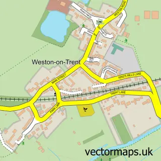
Parish: Weston upon Trent CP
Postcode coverage
POI category counts
Currency Exchange: 3
Pub: 3
Beauty And Spa: 2
Beauty Salon: 2
Building Supply Store: 2
Post Office: 2
Public And Government Association: 2
Archery Range: 1
Arts And Crafts: 1
Bicycle Shop: 1
Sample points of interest
- Wasp Archers
- Craft Consortium
- Monarch Aesthetics & Skin Care
- Naildresser & co
- Nathan Lloyd Hair - Aston on Trent
- Posh Nail and Beauty
- Home Bike Services
- MIMI TOKO
- Bob Neill
- Quarnmill Construction
- All Saints Church
- Aston-On-Trent Memorial Hall
Create a larger editable map of Aston-on-Trent
This sample shows only a 750 metre area. To create a larger map of Aston-on-Trent, use our map builder to choose your own coverage area, add titles and download editable SVG, PDF and PNG files.
Create a custom map of Aston-on-Trent