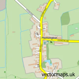
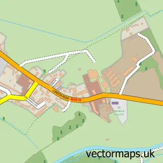
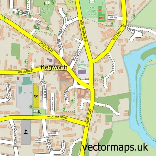
This Castle Donington street map is a detailed vector street map covering a 750m x 750m area. Select a larger area to create and download your own vector street map of Castle Donington.
The 750-metre map sample for Castle Donington covers 655 mapped buildings and approximately 30.0 km of road detail, of which 54 named roads are named. The immediate area includes 2 primary schools and 1 secondary school, 1 GP surgery, 7 pubs and 6 MOT stations within 2 miles. The wider area around Castle Donington features 4 tourism points of interest, 10 food and drink venues and 6 hotels. To create a larger or custom map of Castle Donington, the map builder lets you define your own coverage area and download editable SVG, PDF and PNG files.
Create a larger editable map of Castle Donington
Choose any area you need and generate a high-quality vector map instantly. Perfect for print, planning, design, business and personal use.

This Castle Donington street map in Leicestershire is available as downloadable SVG, PDF and PNG map files, or as a printed map for planning, business, display, education, local information and design work. You can also create a larger custom map area using the map selector.
What this Castle Donington map sample shows
Castle Donington lies within Castle Donington Cp parish, part of Castle Donington Castle ward in the North West Leicestershire District local authority area. The postcode geography for this area includes the DE postcode area, the DE74 postcode district and the DE74 2 postcode sector. Residents fall under the Nhs Leicester, Leicestershire And Rutland Integrated Care Board for NHS services.
Local features near Castle Donington
Within 2 milesAmenities and services in and around Castle Donington.
Administrative and postcode information for Castle Donington
The local authority covering Castle Donington is North West Leicestershire District, within the county of Leicestershire. The settlement lies within Castle Donington Castle ward and Castle Donington Cp civil parish. The DE74 postcode district and DE74 2 postcode sector serve the immediate area. NHS provision in the area is delivered through University Hospitals Of Derby And Burton Nhs Foundation Trust.
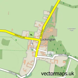
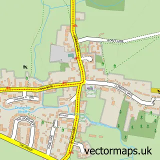
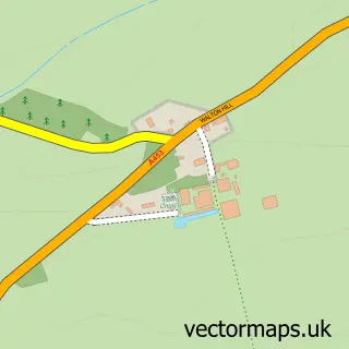
Nearby street map samples around Castle Donington

More street maps in Leicestershire
750 metre map area coverage
Boundary, postcode and point of interest information for the 750m x 750m rectangle centred on this sample map.
Boundaries containing map centre
Constituency: North West Leicestershire Co Const
County: Leicestershire County
District: North West Leicestershire District
Icb: NHS Leicester Leicestershire and Rutland ICB
Parish: Castle Donington CP
Police Force: leicestershire
Postcode District: DE74
Postcode Sector: DE74 2
Nearby boundaries intersecting sample
Ward: Castle Donington Castle Ward, Castle Donington Central Ward, Castle Donington Park Ward
Postcode coverage
POI category counts
Convenience Store: 9
Professional Services: 8
Beauty Salon: 7
Hair Salon: 7
Pub: 7
Hotel: 6
Atms: 5
Beauty And Spa: 4
Church Cathedral: 4
Financial Service: 4
Sample points of interest
- New Wave Marketing
- Orkis Media
- Orkis Media
- Life Balance UK
- The Church of St Edward King & Martyr, Castle Donington
- Once Removed Antiques And Collectables Castle Donington
- Lime Digital Communications
- Castle Donnington
- ATM (Post Office)
- PayPoint
- PayPoint
- Santander
Create a larger editable map of Castle Donington
This sample shows only a 750 metre area. To create a larger map of Castle Donington, use our map builder to choose your own coverage area, add titles and download editable SVG, PDF and PNG files.
Create a custom map of Castle Donington