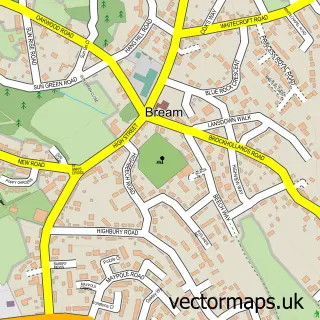
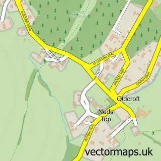
This Aylburton street map is a detailed vector street map covering a 750m x 750m area. Select a larger area to create and download your own vector street map of Aylburton.
The 750-metre map sample for Aylburton covers 168 mapped buildings and approximately 26.2 km of road detail, of which 10 named roads are named. The immediate area includes 1 school, 2 GP surgeries within 2 miles, 3 pubs and 6 MOT stations within 2 miles. The wider area around Aylburton features 1 tourism point of interest, 3 food and drink venues and 1 hotel. To create a larger or custom map of Aylburton, the map builder lets you define your own coverage area and download editable SVG, PDF and PNG files.
Create a larger editable map of Aylburton
Choose any area you need and generate a high-quality vector map instantly. Perfect for print, planning, design, business and personal use.

This Aylburton street map in Gloucestershire is available as downloadable SVG, PDF and PNG map files, or as a printed map for planning, business, display, education, local information and design work. You can also create a larger custom map area using the map selector.
What this Aylburton map sample shows
Aylburton lies within Aylburton Cp parish, part of Lydney West & Aylburton ward in the Forest Of Dean District local authority area. The postcode geography for this area includes the GL postcode area, the GL15 postcode district and the GL15 6 postcode sector. Residents fall under the Nhs Gloucestershire Integrated Care Board for NHS services.
Local features near Aylburton
Within 2 milesAmenities and services in and around Aylburton.
Administrative and postcode information for Aylburton
Aylburton lies within Aylburton Cp parish, part of Lydney West & Aylburton ward in the Forest Of Dean District local authority area. The postcode geography for this area includes the GL postcode area, the GL15 postcode district and the GL15 6 postcode sector. Residents fall under the Nhs Gloucestershire Integrated Care Board for NHS services.
Nearby street map samples around Aylburton

More street maps in Gloucestershire
750 metre map area coverage
Boundary, postcode and point of interest information for the 750m x 750m rectangle centred on this sample map.
Boundaries containing map centre
Constituency: Forest of Dean Co Const
County: Gloucestershire County
District: Forest of Dean District
Icb: NHS Gloucestershire ICB
Parish: Aylburton CP
Police Force: gloucestershire
Postcode District: GL15
Postcode Sector: GL15 6
Ward: Lydney West & Aylburton Ward
Nearby boundaries intersecting sample
Parish: Lydney CP
Postcode coverage
POI category counts
Professional Services: 3
Pub: 3
Anglican Church: 1
Architectural Designer: 1
Arts And Crafts: 1
Carpet Store: 1
Church Cathedral: 1
Community Center: 1
Contractor: 1
Doctor: 1
Sample points of interest
- St Mary's Aylburton
- Apex Architecture Ltd.
- Taurus Crafts
- Andrew Letheren Carpets
- Aylburton Methodist Church
- Aylburton Village Club
- Modular Building Site Services
- Outdoor Medical Solutions Ltd.
- Luke Cole Electrical Services
- Aylburton C of E Primary School
- Roam EV Charging Station
- Fortitude
Create a larger editable map of Aylburton
This sample shows only a 750 metre area. To create a larger map of Aylburton, use our map builder to choose your own coverage area, add titles and download editable SVG, PDF and PNG files.
Create a custom map of Aylburton