Vector Maps logo
Home Why it works Popular maps Districts Samples Customizer Create Your Map
VectorMaps.uk
Home Popular maps Districts Samples Customizer Create Your Map Privacy Disclaimer
Home / UK Maps / Ayrshire and Arran / Beith Map

This Beith street map is a detailed vector street map covering a 750m x 750m area. Select a larger area to create and download your own vector street map of Beith.

Beith is a town in Ayrshire And Arran, in the West Scotland of Scotland. Historically, the area formed part of Ayrshire. The settlement falls within the North Ayrshire And Arran parliamentary constituency. It is served by the KA15 postcode district, with

The 750-metre map sample for Beith covers 362 mapped buildings and approximately 19.2 km of road detail, of which 51 named roads are named. The immediate area includes 1 GP surgery, 3 pubs and 3 MOT stations within 2 miles. The wider area around Beith features 4 tourism points of interest and 8 food and drink venues. To create a larger or custom map of Beith, the map builder lets you define your own coverage area and download editable SVG, PDF and PNG files.

362Buildings
19.15 kmRoads
51Named roads
0Residents within 2 miles
Create your own

Create a larger editable map of Beith

Choose any area you need and generate a high-quality vector map instantly. Perfect for print, planning, design, business and personal use.

Choose any location
Editable SVG files
Any size up to A0
PDF, PNG & more
Instant download
High quality guaranteed
Create My Custom Map
Secure, private & no credit card required
Beith Vector Street Map
750m Sample
Beith vector street map sample showing roads, buildings and local features in a 750 metre preview area
Buy Beith Map Print from £12.95 Buy Beith Digital Map from £6

This Beith street map in Ayrshire and Arran is available as downloadable SVG, PDF and PNG map files, or as a printed map for planning, business, display, education, local information and design work. You can also create a larger custom map area using the map selector.

What this Beith map sample shows

Beith lies within North Ayrshire parish, part of Kilbirnie And Beith ward in the North Ayrshire local authority area. The postcode geography for this area includes the KA postcode area, the KA15 postcode district and the KA15 2 postcode sector. Residents fall under the Ayrshire And Arran for NHS services.

Local features near Beith

Within 2 miles

Amenities and services in and around Beith.

1 GP surgeries 1 within 2 miles
3 MOT stations within 2 miles
4 Tourism & leisure
8 Food & drink
3 Pubs
7 Healthcare POIs
4 Vehicle services

Counts are approximate and based on publicly available data.

Administrative and postcode information for Beith

Beith lies within North Ayrshire parish, part of Kilbirnie And Beith ward in the North Ayrshire local authority area. The postcode geography for this area includes the KA postcode area, the KA15 postcode district and the KA15 2 postcode sector. Residents fall under the Ayrshire And Arran for NHS services.

Parish NORTH AYRSHIRE
Ward Kilbirnie and Beith
District / local authority North Ayrshire
County Ayrshire and Arran
Historic county Ayrshire
Postcode district KA15
Postcode sector KA15 2
Parliamentary constituency North Ayrshire and Arran
Region West Scotland
Country Scotland

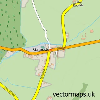
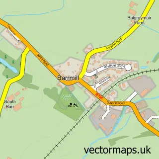
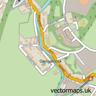
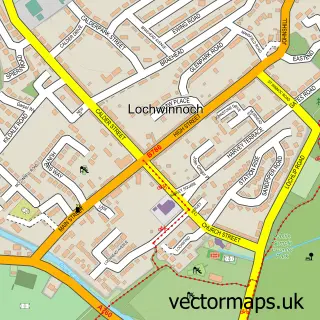
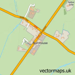
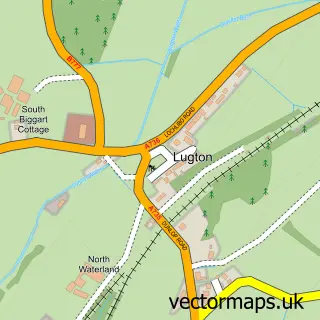
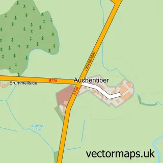
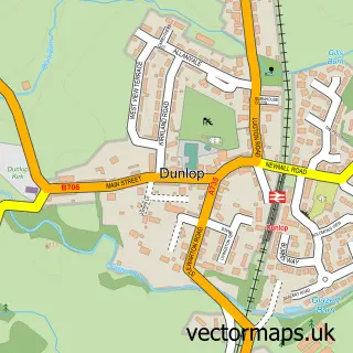
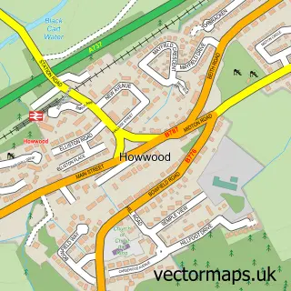
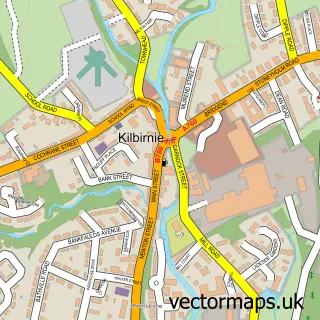
Nearby street map samples around Beith

Street map sample of Glasgow, City of Glasgow Glasgow City - City of Glasgow - 16.7 miles Street map sample of Gateside, Ayrshire and Arran Gateside Village - Ayrshire and Arran - 0.9 miles Street map sample of Barrmill, Ayrshire and Arran Barrmill Village - Ayrshire and Arran - 1.9 miles Street map sample of Glengarnock, Ayrshire and Arran Glengarnock Village - Ayrshire and Arran - 2.0 miles Street map sample of Lochwinnoch, Renfrewshire Lochwinnoch Village - Renfrewshire - 3.1 miles Street map sample of Burnhouse, Ayrshire and Arran Burnhouse Village - Ayrshire and Arran - 3.2 miles Street map sample of Lugton, Ayrshire and Arran Lugton Village - Ayrshire and Arran - 4.1 miles Street map sample of Auchentiber, Ayrshire and Arran Auchentiber Village - Ayrshire and Arran - 4.3 miles Street map sample of Dunlop, Ayrshire and Arran Dunlop Village - Ayrshire and Arran - 4.6 miles Street map sample of Howwood, Renfrewshire Howwood Village - Renfrewshire - 5.0 miles

More street maps in Ayrshire and Arran

Street map sample of Gateside, Ayrshire and Arran Gateside Village - 0.9 miles Street map sample of Barrmill, Ayrshire and Arran Barrmill Village - 1.9 miles Street map sample of Glengarnock, Ayrshire and Arran Glengarnock Village - 2.0 miles Street map sample of Kilbirnie, Ayrshire and Arran Kilbirnie Town - 2.1 miles Street map sample of Burnhouse, Ayrshire and Arran Burnhouse Village - 3.2 miles

750 metre map area coverage

Boundary, postcode and point of interest information for the 750m x 750m rectangle centred on this sample map.

Boundaries containing map centre

Constituency: North Ayrshire and Arran Co Const

District: North Ayrshire

Icb: Ayrshire and Arran

Postcode District: KA15

Postcode Sector: KA15 2

Ward: Garnock Valley Ward

Nearby boundaries intersecting sample

Postcode Sector: KA15 1

Postcode coverage

KA15 KA15 2 KA15 1

POI category counts

Beauty Salon: 6

Bakery: 3

Barber: 3

Chinese Restaurant: 3

Church Cathedral: 3

Coffee Shop: 3

Convenience Store: 3

Fish And Chips Restaurant: 3

Flowers And Gifts Shop: 3

Funeral Services And Cemeteries: 3

Sample points of interest

  • Mckenzie Bryson & Marshall Animal Hospital
  • Byre Antiques Antique Store
  • MS Ventilation Appliance Manufacturer
  • Beith Domestics Appliance Store
  • Cunninghame Choir Arts And Entertainment
  • Beith Respite Centre Assisted Living Facility
  • Laigh Court Sheltered Housing Assisted Living Facility
  • PayPoint Atms
  • The Cooperative Food (BF) Beith (ERF) Atms
  • Dunmuir Coachworks Automotive Repair
  • Garnock Mot Centre Automotive Repair
  • Buns & Crumbs Bakery

Create a larger editable map of Beith

This sample shows only a 750 metre area. To create a larger map of Beith, use our map builder to choose your own coverage area, add titles and download editable SVG, PDF and PNG files.

Create a custom map of Beith

Phone 01751 473136 | Copyright Vectormaps.uk 2026

Samples Customizer Privacy Disclaimer
Beith Vector Street Map
Beith enlarged street map sample showing a 750 metre preview area