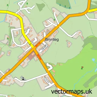
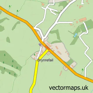
This Benllech street map is a detailed vector street map covering a 750m x 750m area. Select a larger area to create and download your own vector street map of Benllech.
The 750-metre map sample for Benllech covers 249 mapped buildings and approximately 10.1 km of road detail, of which 9 named roads are named. The immediate area includes 1 pub and 1 MOT station within 2 miles. The wider area around Benllech features 2 tourism points of interest, 9 food and drink venues and 8 hotels. To create a larger or custom map of Benllech, the map builder lets you define your own coverage area and download editable SVG, PDF and PNG files.
Create a larger editable map of Benllech
Choose any area you need and generate a high-quality vector map instantly. Perfect for print, planning, design, business and personal use.

This Benllech street map in Gwynedd is available as downloadable SVG, PDF and PNG map files, or as a printed map for planning, business, display, education, local information and design work. You can also create a larger custom map area using the map selector.
What this Benllech map sample shows
Benllech lies within Llanfair-Mathafarn-Eithaf Community parish, part of Lligwy ward in the Sir Ynys Mon - Isle Of Anglesey local authority area. The postcode geography for this area includes the LL postcode area, the LL74 postcode district and the LL74 8 postcode sector. Residents fall under the Betsi Cadwaladr University Health Board for NHS services.
Local features near Benllech
Within 2 milesAmenities and services in and around Benllech.
Administrative and postcode information for Benllech
Benllech lies within Llanfair-Mathafarn-Eithaf Community parish, part of Lligwy ward in the Sir Ynys Mon - Isle Of Anglesey local authority area. The postcode geography for this area includes the LL postcode area, the LL74 postcode district and the LL74 8 postcode sector. Residents fall under the Betsi Cadwaladr University Health Board for NHS services.
Nearby street map samples around Benllech

More street maps in Gwynedd
750 metre map area coverage
Boundary, postcode and point of interest information for the 750m x 750m rectangle centred on this sample map.
Boundaries containing map centre
Constituency: Ynys Mon Co Const
District: Sir Ynys Mon - Isle of Anglesey
Icb: Betsi Cadwaladr University
Parish: Llanfair-Mathafarn-Eithaf Community
Police Force: north wales
Postcode District: LL74
Postcode Sector: LL74 8
Nearby boundaries intersecting sample
No additional intersecting boundaries found.
Postcode coverage
POI category counts
Holiday Rental Home: 6
Hotel: 5
Beach: 4
Cafe: 4
Indian Restaurant: 3
Restaurant: 3
Rv Park: 3
Bed And Breakfast: 2
Arts And Entertainment: 1
Bakery: 1
Sample points of interest
- Tyddyn Mon
- Lewy’s Loaf
- Benllech Beach
- Benllech Post Office
- Traeth Benllech
- Traeth Benllech.
- Castaway
- The Sea View Guest House
- Dulas Boat & Caravan
- Bradleys Coffee Shop
- The Shed Benllech
- The Wendon Cafe & Seaside Shop
Create a larger editable map of Benllech
This sample shows only a 750 metre area. To create a larger map of Benllech, use our map builder to choose your own coverage area, add titles and download editable SVG, PDF and PNG files.
Create a custom map of Benllech