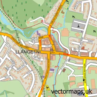
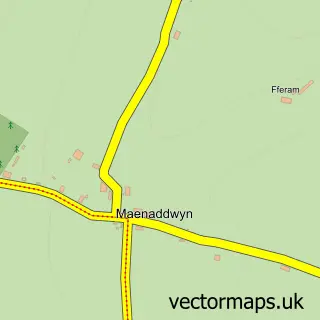
This Marian-glas street map is a detailed vector street map covering a 750m x 750m area. Select a larger area to create and download your own vector street map of Marian-glas.
The 750-metre map sample for Marian-glas covers 123 mapped buildings and approximately 11.9 km of road detail, of which 1 named road are named. The immediate area includes 1 pub and 1 MOT station within 2 miles. The wider area around Marian-glas features 2 tourism points of interest, 1 food and drink venue and 1 hotel. To create a larger or custom map of Marian-glas, the map builder lets you define your own coverage area and download editable SVG, PDF and PNG files.
Create a larger editable map of Marian-glas
Choose any area you need and generate a high-quality vector map instantly. Perfect for print, planning, design, business and personal use.

This Marian-glas street map in Gwynedd is available as downloadable SVG, PDF and PNG map files, or as a printed map for planning, business, display, education, local information and design work. You can also create a larger custom map area using the map selector.
What this Marian-glas map sample shows
Marian-glas lies within Llaneugrad Community parish, part of Lligwy ward in the Sir Ynys Mon - Isle Of Anglesey local authority area. The postcode geography for this area includes the LL postcode area, the LL73 postcode district and the LL73 8 postcode sector. Residents fall under the Betsi Cadwaladr University Health Board for NHS services.
Local features near Marian-glas
Within 2 milesAmenities and services in and around Marian-glas.
Administrative and postcode information for Marian-glas
The local authority covering Marian-glas is Sir Ynys Mon - Isle Of Anglesey, within the county of Gwynedd. The settlement lies within Lligwy ward and Llaneugrad Community civil parish. The LL73 postcode district and LL73 8 postcode sector serve the immediate area. NHS provision in the area is delivered through Betsi Cadwaladr University Health Board.
Nearby street map samples around Marian-glas

More street maps in Gwynedd
750 metre map area coverage
Boundary, postcode and point of interest information for the 750m x 750m rectangle centred on this sample map.
Boundaries containing map centre
Constituency: Ynys Mon Co Const
District: Sir Ynys Mon - Isle of Anglesey
Icb: Betsi Cadwaladr University
Parish: Llaneugrad Community
Police Force: north wales
Postcode District: LL73
Postcode Sector: LL73 8
Nearby boundaries intersecting sample
Parish: Llanfair-Mathafarn-Eithaf Community, Moelfre Community
Postcode coverage
POI category counts
Campground: 2
Cottage: 1
Funeral Services And Cemeteries: 1
Gardener: 1
Plasterer: 1
Plumbing: 1
Pool Billiards: 1
Pub: 1
Reflexology: 1
Rv Park: 1
Sample points of interest
- Cae Mawr Caravan and Motorhome Club Campsite
- Chateau Sierra
- The Cottage, Marianglas
- Arwyn Hughes Funeral Director
- Botanical Blooms Gardening Services
- G W Farrell Plasterer
- I Parry & Son
- Dragon Games
- The Parciau Arms
- Me Time Reflexology
- Parciau Caravan Park
Create a larger editable map of Marian-glas
This sample shows only a 750 metre area. To create a larger map of Marian-glas, use our map builder to choose your own coverage area, add titles and download editable SVG, PDF and PNG files.
Create a custom map of Marian-glas