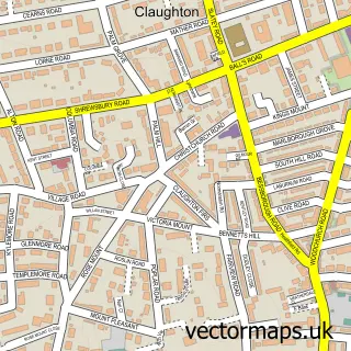
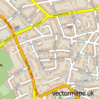
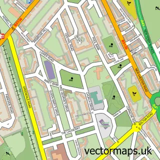
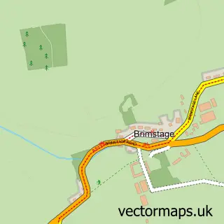
This Birkenhead street map is a detailed vector street map covering a 750m x 750m area. Select a larger area to create and download your own vector street map of Birkenhead.
The 750-metre map sample for Birkenhead covers 216 mapped buildings and approximately 26.7 km of road detail, of which 65 named roads are named. The immediate area includes 1 school, 1 railway station, 1 GP surgery, with 15 within 2 miles and 7 pubs among other local services. The wider area around Birkenhead features 4 tourism points of interest and 30 food and drink venues. To create a larger or custom map of Birkenhead, the map builder lets you define your own coverage area and download editable SVG, PDF and PNG files.
Create a larger editable map of Birkenhead
Choose any area you need and generate a high-quality vector map instantly. Perfect for print, planning, design, business and personal use.

This Birkenhead street map in Merseyside is available as downloadable SVG, PDF and PNG map files, or as a printed map for planning, business, display, education, local information and design work. You can also create a larger custom map area using the map selector.
What this Birkenhead map sample shows
Birkenhead lies within Wirral District (B) parish, part of Birkenhead And Tranmere ward in the Wirral District (B) local authority area. The postcode geography for this area includes the CH postcode area, the CH41 postcode district and the CH41 5 postcode sector. Residents fall under the Nhs Cheshire And Merseyside Integrated Care Board for NHS services.
Local features near Birkenhead
Within 2 milesAmenities and services in and around Birkenhead.
Administrative and postcode information for Birkenhead
The local authority covering Birkenhead is Wirral District (B), within the county of Merseyside. The settlement lies within Birkenhead And Tranmere ward and Wirral District (B) civil parish. The CH41 postcode district and CH41 5 postcode sector serve the immediate area. NHS provision in the area is delivered through Wirral University Teaching Hospital Nhs Foundation Trust.
Nearby street map samples around Birkenhead

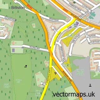
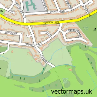
More street maps in Merseyside
750 metre map area coverage
Boundary, postcode and point of interest information for the 750m x 750m rectangle centred on this sample map.
Boundaries containing map centre
Constituency: Birkenhead Boro Const
District: Wirral District (B)
Icb: NHS Cheshire and Merseyside ICB
Police Force: merseyside
Postcode District: CH41
Postcode Sector: CH41 2
Ward: Birkenhead and Tranmere Ward
Nearby boundaries intersecting sample
Postcode Sector: CH41 4, CH41 5, CH41 6, CH41 9
Postcode coverage
POI category counts
Clothing Store: 20
Jewelry Store: 16
Cafe: 11
Bakery: 10
Coffee Shop: 10
Gift Shop: 10
Retail: 9
Womens Clothing Store: 9
Bar: 8
Charity Organization: 8
Sample points of interest
- Nightingales Recovery Cafe
- YMC a
- Oasis Amusements
- Showboat
- British Heart Foundation Furniture & Electrical
- Shaw Trust - Charity shop - Birkenhead
- Brighthouse
- Iceland Foods
- FM Cosmetics Birkenhead
- Convenience Gallery
- Tate Aisle Gallery
- Bamboo Knitting and Crochet Centre
Create a larger editable map of Birkenhead
This sample shows only a 750 metre area. To create a larger map of Birkenhead, use our map builder to choose your own coverage area, add titles and download editable SVG, PDF and PNG files.
Create a custom map of Birkenhead