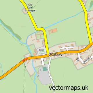
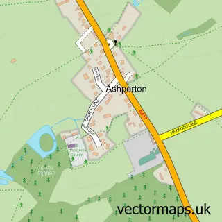
This Bishop's Frome street map is a detailed vector street map covering a 750m x 750m area. Select a larger area to create and download your own vector street map of Bishop's Frome.
The 750-metre map sample for Bishop's Frome covers 95 mapped buildings and approximately 34.8 km of road detail, of which 3 named roads are named. The immediate area includes 3 pubs and 1 MOT station, with 2 within 2 miles. The wider area around Bishop's Frome features 3 food and drink venues and 1 hotel. To create a larger or custom map of Bishop's Frome, the map builder lets you define your own coverage area and download editable SVG, PDF and PNG files.
Create a larger editable map of Bishop's Frome
Choose any area you need and generate a high-quality vector map instantly. Perfect for print, planning, design, business and personal use.

This Bishop's Frome street map in Herefordshire is available as downloadable SVG, PDF and PNG map files, or as a printed map for planning, business, display, education, local information and design work. You can also create a larger custom map area using the map selector.
What this Bishop's Frome map sample shows
Bishop's Frome lies within Bishop's Frome Cp parish, part of Bishops Frome & Cradley ward in the County Of Herefordshire local authority area. The postcode geography for this area includes the WR postcode area, the WR6 postcode district and the WR6 5 postcode sector. Residents fall under the Nhs Herefordshire And Worcestershire Integrated Care Board for NHS services.
Local features near Bishop's Frome
Within 2 milesAmenities and services in and around Bishop's Frome.
Administrative and postcode information for Bishop's Frome
Bishop's Frome lies within Bishop's Frome Cp parish, part of Bishops Frome & Cradley ward in the County Of Herefordshire local authority area. The postcode geography for this area includes the WR postcode area, the WR6 postcode district and the WR6 5 postcode sector. Residents fall under the Nhs Herefordshire And Worcestershire Integrated Care Board for NHS services.
Nearby street map samples around Bishop's Frome

More street maps in Herefordshire
750 metre map area coverage
Boundary, postcode and point of interest information for the 750m x 750m rectangle centred on this sample map.
Boundaries containing map centre
Constituency: North Herefordshire Co Const
District: County of Herefordshire
Icb: NHS Herefordshire and Worcestershire ICB
Parish: Bishop's Frome CP
Police Force: west mercia
Postcode District: WR6
Postcode Sector: WR6 5
Ward: Bishops Frome & Cradley Ward
Nearby boundaries intersecting sample
No additional intersecting boundaries found.
Postcode coverage
POI category counts
Pub: 3
Industrial Equipment: 2
Korean Grocery Store: 2
Anglican Church: 1
Automotive Parts And Accessories: 1
Automotive Repair: 1
Business Manufacturing And Supply: 1
Church Cathedral: 1
Construction Services: 1
Electrician: 1
Sample points of interest
- Bishops Frome: St Mary the Virgin
- ISLA Components Ltd
- BC Partridge
- Apreco Limited
- Church of St Mary the Virgin, Bishops Frome
- Owen Developments
- On Point Energy Ltd.
- Camcraft Ltd
- Bishops Frome Village Hall
- Goodman's Geese and Bronze Turkeys
- David Trueman-Eade
- Apreco Ltd.
Create a larger editable map of Bishop's Frome
This sample shows only a 750 metre area. To create a larger map of Bishop's Frome, use our map builder to choose your own coverage area, add titles and download editable SVG, PDF and PNG files.
Create a custom map of Bishop's Frome