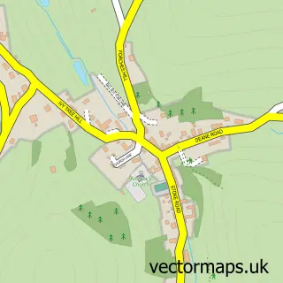
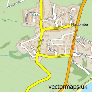
This Bishopsteignton street map is a detailed vector street map covering a 750m x 750m area. Select a larger area to create and download your own vector street map of Bishopsteignton.
The 750-metre map sample for Bishopsteignton covers 501 mapped buildings and approximately 18.8 km of road detail, of which 35 named roads are named. The immediate area includes 1 school, 2 pubs and 1 MOT station, with 4 within 2 miles. The wider area around Bishopsteignton features 2 tourism points of interest, 2 food and drink venues and 2 hotels. To create a larger or custom map of Bishopsteignton, the map builder lets you define your own coverage area and download editable SVG, PDF and PNG files.
Create a larger editable map of Bishopsteignton
Choose any area you need and generate a high-quality vector map instantly. Perfect for print, planning, design, business and personal use.

This Bishopsteignton street map in Devon is available as downloadable SVG, PDF and PNG map files, or as a printed map for planning, business, display, education, local information and design work. You can also create a larger custom map area using the map selector.
What this Bishopsteignton map sample shows
Bishopsteignton lies within Bishopsteignton Cp parish, part of Bishopsteignton ward in the Teignbridge District local authority area. The postcode geography for this area includes the TQ postcode area, the TQ14 postcode district and the TQ14 9 postcode sector. Residents fall under the Nhs Devon Integrated Care Board for NHS services.
Local features near Bishopsteignton
Within 2 milesAmenities and services in and around Bishopsteignton.
Administrative and postcode information for Bishopsteignton
Bishopsteignton lies within Bishopsteignton Cp parish, part of Bishopsteignton ward in the Teignbridge District local authority area. The postcode geography for this area includes the TQ postcode area, the TQ14 postcode district and the TQ14 9 postcode sector. Residents fall under the Nhs Devon Integrated Care Board for NHS services.
Nearby street map samples around Bishopsteignton

More street maps in Devon
750 metre map area coverage
Boundary, postcode and point of interest information for the 750m x 750m rectangle centred on this sample map.
Boundaries containing map centre
Constituency: Newton Abbot Co Const
County: Devon County
District: Teignbridge District
Icb: NHS Devon ICB
Parish: Bishopsteignton CP
Police Force: devon and cornwall
Postcode District: TQ14
Postcode Sector: TQ14 9
Ward: Bishopsteignton Ward
Nearby boundaries intersecting sample
No additional intersecting boundaries found.
Postcode coverage
POI category counts
Professional Services: 3
Business Management Services: 2
Community Center: 2
Hotel: 2
Parking: 2
Pub: 2
Retirement Home: 2
Appliance Store: 1
Aquatic Pet Store: 1
Assisted Living Facility: 1
Sample points of interest
- Home Appliance Repairs
- UKReef Marine Ltd
- Bishopsteignton House
- Cockhaven Manor Inn
- No 43 Beauty & Aesthetics
- The Hair Studio
- Bishopsteignton Post Office
- Post Office-Bishopsteignton
- St Mary the Virgin C of E Church
- Bishopsteignton Community Centre
- Bishopsteignton Village Hall
- Supply Stores
Create a larger editable map of Bishopsteignton
This sample shows only a 750 metre area. To create a larger map of Bishopsteignton, use our map builder to choose your own coverage area, add titles and download editable SVG, PDF and PNG files.
Create a custom map of Bishopsteignton