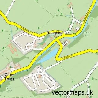
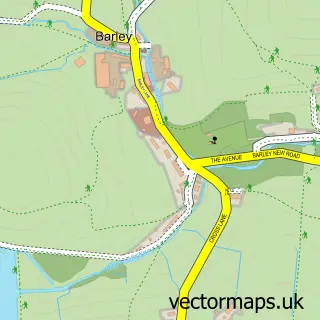
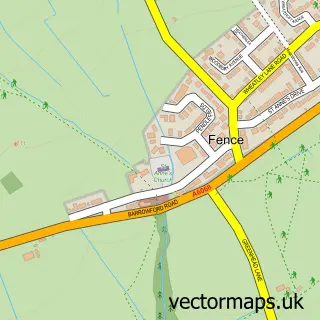
This Blacko street map is a detailed vector street map covering a 750m x 750m area. Select a larger area to create and download your own vector street map of Blacko.
The 750-metre map sample for Blacko covers 113 mapped buildings and approximately 6.5 km of road detail, of which 6 named roads are named. The immediate area includes 1 school, 1 GP surgery within 2 miles, 2 pubs and 13 MOT stations within 2 miles. The wider area around Blacko features 1 tourism point of interest and 2 food and drink venues. To create a larger or custom map of Blacko, the map builder lets you define your own coverage area and download editable SVG, PDF and PNG files.
Create a larger editable map of Blacko
Choose any area you need and generate a high-quality vector map instantly. Perfect for print, planning, design, business and personal use.

This Blacko street map in Lancashire is available as downloadable SVG, PDF and PNG map files, or as a printed map for planning, business, display, education, local information and design work. You can also create a larger custom map area using the map selector.
What this Blacko map sample shows
Blacko lies within Blacko Cp parish, part of Blacko And Higherford ward in the Pendle District (B) local authority area. The postcode geography for this area includes the BB postcode area, the BB9 postcode district and the BB9 6 postcode sector. Residents fall under the Nhs Lancashire And South Cumbria Integrated Care Board for NHS services.
Local features near Blacko
Within 2 milesAmenities and services in and around Blacko.
Administrative and postcode information for Blacko
Blacko lies within Blacko Cp parish, part of Blacko And Higherford ward in the Pendle District (B) local authority area. The postcode geography for this area includes the BB postcode area, the BB9 postcode district and the BB9 6 postcode sector. Residents fall under the Nhs Lancashire And South Cumbria Integrated Care Board for NHS services.
Nearby street map samples around Blacko
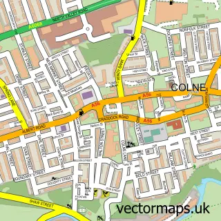

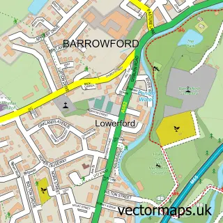
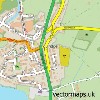
More street maps in Lancashire
750 metre map area coverage
Boundary, postcode and point of interest information for the 750m x 750m rectangle centred on this sample map.
Boundaries containing map centre
Constituency: Pendle and Clitheroe Co Const
County: Lancashire County
District: Pendle District (B)
Icb: NHS Lancashire and South Cumbria ICB
Parish: Blacko CP
Police Force: lancashire
Postcode District: BB9
Postcode Sector: BB9 6
Ward: Barrowford & Pendleside Ward
Nearby boundaries intersecting sample
No additional intersecting boundaries found.
Postcode coverage
POI category counts
Pub: 2
Assisted Living Facility: 1
Beauty Salon: 1
Elementary School: 1
Fitness Trainer: 1
Holiday Rental Home: 1
Landmark And Historical Building: 1
Pet Groomer: 1
Public Service And Government: 1
Real Estate Agent: 1
Sample points of interest
- Pendle Brook House
- Pulse hair design
- Blacko Primary School
- Iplay Soccer Schools UK
- The Garden Apartment
- Blacko
- Claire Smith Dog Grooming
- Rising Sun Inn
- The Rising Sun
- Blacko Parish Council
- The Kelbrook Mill Co
- Process Treatments
Create a larger editable map of Blacko
This sample shows only a 750 metre area. To create a larger map of Blacko, use our map builder to choose your own coverage area, add titles and download editable SVG, PDF and PNG files.
Create a custom map of Blacko