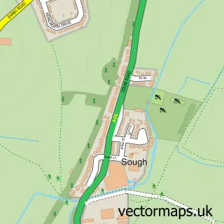
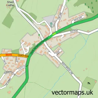
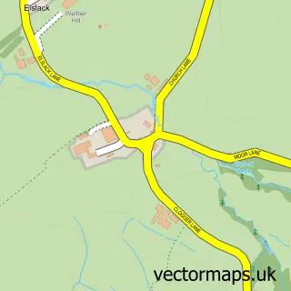
This Salterforth street map is a detailed vector street map covering a 750m x 750m area. Select a larger area to create and download your own vector street map of Salterforth.
The 750-metre map sample for Salterforth covers 104 mapped buildings and approximately 7.0 km of road detail, of which 10 named roads are named. The immediate area includes 1 school, 2 GP surgeries within 2 miles, 2 pubs and 10 MOT stations within 2 miles. The wider area around Salterforth features 1 tourism point of interest and 2 food and drink venues. To create a larger or custom map of Salterforth, the map builder lets you define your own coverage area and download editable SVG, PDF and PNG files.
Create a larger editable map of Salterforth
Choose any area you need and generate a high-quality vector map instantly. Perfect for print, planning, design, business and personal use.

This Salterforth street map in Lancashire is available as downloadable SVG, PDF and PNG map files, or as a printed map for planning, business, display, education, local information and design work. You can also create a larger custom map area using the map selector.
What this Salterforth map sample shows
Salterforth lies within Salterforth Cp parish, part of Earby ward in the Pendle District (B) local authority area. The postcode geography for this area includes the BB postcode area, the BB18 postcode district and the BB18 5 postcode sector. Residents fall under the Nhs Lancashire And South Cumbria Integrated Care Board for NHS services.
Local features near Salterforth
Within 2 milesAmenities and services in and around Salterforth.
Administrative and postcode information for Salterforth
Salterforth lies within Salterforth Cp parish, part of Earby ward in the Pendle District (B) local authority area. The postcode geography for this area includes the BB postcode area, the BB18 postcode district and the BB18 5 postcode sector. Residents fall under the Nhs Lancashire And South Cumbria Integrated Care Board for NHS services.
Nearby street map samples around Salterforth

More street maps in Lancashire
750 metre map area coverage
Boundary, postcode and point of interest information for the 750m x 750m rectangle centred on this sample map.
Boundaries containing map centre
Constituency: Pendle and Clitheroe Co Const
County: Lancashire County
District: Pendle District (B)
Icb: NHS Lancashire and South Cumbria ICB
Parish: Salterforth CP
Police Force: lancashire
Postcode District: BB18
Postcode Sector: BB18 5
Ward: Earby & Coates Ward
Nearby boundaries intersecting sample
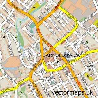
Parish: Barnoldswick CP
Postcode Sector: BB18 6
Ward: Barnoldswick Ward
Postcode coverage
POI category counts
Elementary School: 2
Pub: 2
Automotive Repair: 1
Bakery: 1
Convenience Store: 1
Education: 1
Language School: 1
Park: 1
Public Service And Government: 1
Storage Facility: 1
Sample points of interest
- Hayfield Garage
- Love Sweet Thing
- SPAR Kelbrook Road
- West Craven High School
- Salterforth Primary School
- Salterforth Primary School
- La Jolie Ronde Languages for Children
- Salterforth park
- Anchor Inn Salterforth
- The Anchor Inn
- Barnoldswick CE School
- The Removal Co
Create a larger editable map of Salterforth
This sample shows only a 750 metre area. To create a larger map of Salterforth, use our map builder to choose your own coverage area, add titles and download editable SVG, PDF and PNG files.
Create a custom map of Salterforth