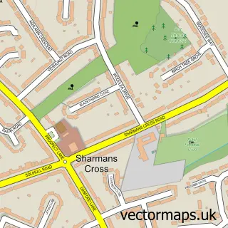
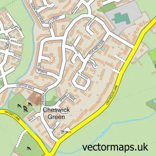
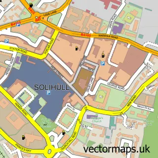
This Blossomfield street map is a detailed vector street map covering a 750m x 750m area. Select a larger area to create and download your own vector street map of Blossomfield.
The 750-metre map sample for Blossomfield covers 374 mapped buildings and approximately 32.5 km of road detail, of which 29 named roads are named. The immediate area includes 5 GP surgeries within 2 miles and 16 MOT stations within 2 miles. To create a larger or custom map of Blossomfield, the map builder lets you define your own coverage area and download editable SVG, PDF and PNG files.
Create a larger editable map of Blossomfield
Choose any area you need and generate a high-quality vector map instantly. Perfect for print, planning, design, business and personal use.

This Blossomfield street map in West Midlands is available as downloadable SVG, PDF and PNG map files, or as a printed map for planning, business, display, education, local information and design work. You can also create a larger custom map area using the map selector.
What this Blossomfield map sample shows
Blossomfield lies within Solihull District (B) parish, part of Shirley East ward in the Solihull District (B) local authority area. The postcode geography for this area includes the B postcode area, the B90 postcode district and the B90 3 postcode sector. Residents fall under the Nhs Birmingham And Solihull Integrated Care Board for NHS services.
Local features near Blossomfield
Within 2 milesAmenities and services in and around Blossomfield.
Administrative and postcode information for Blossomfield
The local authority covering Blossomfield is Solihull District (B), within the county of West Midlands. The settlement lies within Shirley East ward and Solihull District (B) civil parish. The B90 postcode district and B90 3 postcode sector serve the immediate area. NHS provision in the area is delivered through University Hospitals Birmingham Nhs Foundation Trust.
Nearby street map samples around Blossomfield


More street maps in West Midlands
750 metre map area coverage
Boundary, postcode and point of interest information for the 750m x 750m rectangle centred on this sample map.
Boundaries containing map centre
Constituency: Solihull West and Shirley Boro Const
District: Solihull District (B)
Icb: NHS Birmingham and Solihull ICB
Police Force: west midlands
Postcode District: B91
Postcode Sector: B91 1
Ward: Shirley East Ward
Nearby boundaries intersecting sample
Postcode District: B90
Postcode Sector: B90 3, B91 3
Ward: Shirley South Ward, St. Alphege Ward
Postcode coverage
POI category counts
Acupuncture: 2
Alternative Medicine: 2
Doctor: 2
General Dentistry: 2
Auto Upholstery: 1
Beauty And Spa: 1
Beauty Salon: 1
Bookstore: 1
Business Consulting: 1
Dentist: 1
Sample points of interest
- Arden Acupuncture
- Arden Acupuncture
- Bioenergy Partnership
- Total Health And Balance
- County & Solihull Upholstery
- JC Aesthetic Perfection Ltd
- All Round CBD
- Helion & Co
- Northcliffe
- Dr Marek Skalka Solihull
- Blossomfield Surgery
- Blossomfield Surgery (Solihull Healthcare Partnership)
Create a larger editable map of Blossomfield
This sample shows only a 750 metre area. To create a larger map of Blossomfield, use our map builder to choose your own coverage area, add titles and download editable SVG, PDF and PNG files.
Create a custom map of Blossomfield