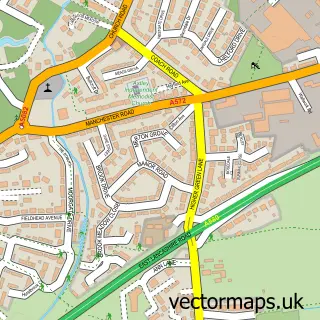
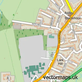
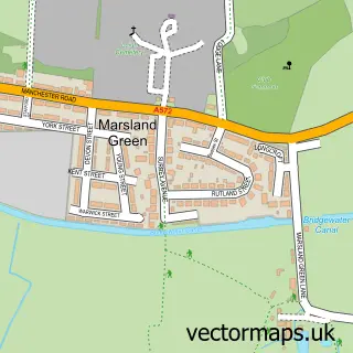
This Boothstown street map is a detailed vector street map covering a 750m x 750m area. Select a larger area to create and download your own vector street map of Boothstown.
The 750-metre map sample for Boothstown covers 596 mapped buildings and approximately 22.7 km of road detail, of which 60 named roads are named. The immediate area includes 2 schools, 1 GP surgery, with 13 within 2 miles, 2 pubs and 9 MOT stations within 2 miles. The wider area around Boothstown features 1 tourism point of interest and 6 food and drink venues. To create a larger or custom map of Boothstown, the map builder lets you define your own coverage area and download editable SVG, PDF and PNG files.
Create a larger editable map of Boothstown
Choose any area you need and generate a high-quality vector map instantly. Perfect for print, planning, design, business and personal use.

This Boothstown street map in Greater Manchester is available as downloadable SVG, PDF and PNG map files, or as a printed map for planning, business, display, education, local information and design work. You can also create a larger custom map area using the map selector.
What this Boothstown map sample shows
Boothstown lies within Salford District (B) parish, part of Boothstown And Ellenbrook ward in the Salford District (B) local authority area. The postcode geography for this area includes the M postcode area, the M28 postcode district and the M28 1 postcode sector. Residents fall under the Nhs Greater Manchester Integrated Care Board for NHS services.
Local features near Boothstown
Within 2 milesAmenities and services in and around Boothstown.
Administrative and postcode information for Boothstown
The local authority covering Boothstown is Salford District (B), within the county of Greater Manchester. The settlement lies within Boothstown And Ellenbrook ward and Salford District (B) civil parish. The M28 postcode district and M28 1 postcode sector serve the immediate area. NHS provision in the area is delivered through Northern Care Alliance Nhs Foundation Trust.
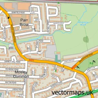
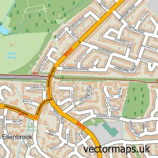
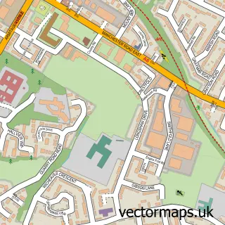
Nearby street map samples around Boothstown

More street maps in Greater Manchester
750 metre map area coverage
Boundary, postcode and point of interest information for the 750m x 750m rectangle centred on this sample map.
Boundaries containing map centre
Constituency: Worsley and Eccles Co Const
District: Salford District (B)
Icb: NHS Greater Manchester ICB
Police Force: greater manchester
Postcode District: M28
Postcode Sector: M28 1
Ward: Boothstown & Ellenbrook Ward
Nearby boundaries intersecting sample
District: Wigan District (B)
Ward: Tyldesley & Mosley Common Ward
Postcode coverage
POI category counts
Hair Salon: 10
Beauty Salon: 6
Retail: 4
Bar: 3
Beauty And Spa: 3
Elementary School: 3
Barber: 2
Building Supply Store: 2
Chinese Restaurant: 2
Church Cathedral: 2
Sample points of interest
- FC Bridgewater
- St Andrew's Church, Boothstown
- Pictor Gallery Custom Framing
- Brian Mulford
- Chadderspoons
- Maltdog
- The Windmill Sports & Social Club
- Buffalo Bar and Grill
- Scott&Westbury Barbers
- The Cutthroat Barbershop
- Hairport Hair & Beauty Leigh
- Semi Permanent Make Up Centre
Create a larger editable map of Boothstown
This sample shows only a 750 metre area. To create a larger map of Boothstown, use our map builder to choose your own coverage area, add titles and download editable SVG, PDF and PNG files.
Create a custom map of Boothstown