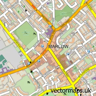
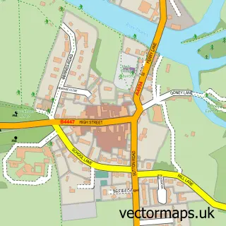
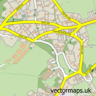
This Bourne End street map is a detailed vector street map covering a 750m x 750m area. Select a larger area to create and download your own vector street map of Bourne End.
The 750-metre map sample for Bourne End covers 542 mapped buildings and approximately 19.7 km of road detail, of which 43 named roads are named. The immediate area includes 1 school, 1 railway station, 2 GP surgeries within 2 miles and 1 MOT station, with 7 within 2 miles. The wider area around Bourne End features 2 tourism points of interest and 8 food and drink venues. To create a larger or custom map of Bourne End, the map builder lets you define your own coverage area and download editable SVG, PDF and PNG files.
Create a larger editable map of Bourne End
Choose any area you need and generate a high-quality vector map instantly. Perfect for print, planning, design, business and personal use.

This Bourne End street map in Buckinghamshire is available as downloadable SVG, PDF and PNG map files, or as a printed map for planning, business, display, education, local information and design work. You can also create a larger custom map area using the map selector.
What this Bourne End map sample shows
Bourne End lies within Wooburn Cp parish, part of Bourne End-Cum-Hedsor ward in the Buckinghamshire local authority area. The postcode geography for this area includes the SL postcode area, the SL8 postcode district and the SL8 5 postcode sector. Residents fall under the Nhs Buckinghamshire, Oxfordshire And Berkshire West Integrated Care Board for NHS services.
Local features near Bourne End
Within 2 milesAmenities and services in and around Bourne End.
Administrative and postcode information for Bourne End
The local authority covering Bourne End is Buckinghamshire, within the county of Buckinghamshire. The settlement lies within Bourne End-Cum-Hedsor ward and Wooburn Cp civil parish. The SL8 postcode district and SL8 5 postcode sector serve the immediate area. NHS provision in the area is delivered through Buckinghamshire Healthcare Nhs Trust.
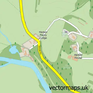
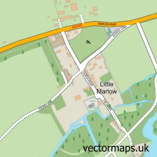
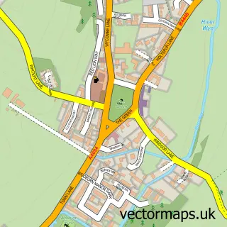
Nearby street map samples around Bourne End

More street maps in Buckinghamshire
750 metre map area coverage
Boundary, postcode and point of interest information for the 750m x 750m rectangle centred on this sample map.
Boundaries containing map centre
Constituency: Beaconsfield Co Const
District: Buckinghamshire
Icb: NHS Thames Valley ICB
Parish: Wooburn CP
Police Force: thames valley
Postcode District: SL8
Postcode Sector: SL8 5
Ward: Flackwell Heath & The Wooburns Ward
Nearby boundaries intersecting sample
Constituency: Maidenhead Co Const
District: Windsor and Maidenhead (B)
Icb: NHS Frimley ICB
Parish: Cookham CP, Little Marlow CP
Ward: Bisham & Cookham Ward, Chiltern Villages Ward
Postcode coverage
POI category counts
Advertising Agency: 7
Cafe: 5
Information Technology Company: 5
Key And Locksmith: 5
Accountant: 4
Business Consulting: 4
Convenience Store: 4
Gas Station: 4
Printing Services: 4
Professional Services: 4
Sample points of interest
- Bourne End
- Another Answer
- Another Answer
- Azets
- Hj Accounting Ltd.
- Buckinghamshire Adult Learning
- Fluro Ltd
- Fogarty Patchett Design
- Graphic Arts Supplies
- Guerilla Creative
- Marketing for Trades
- Moulden Marketing
Create a larger editable map of Bourne End
This sample shows only a 750 metre area. To create a larger map of Bourne End, use our map builder to choose your own coverage area, add titles and download editable SVG, PDF and PNG files.
Create a custom map of Bourne End