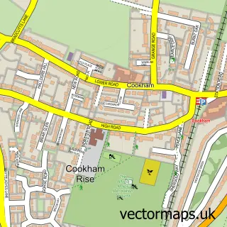
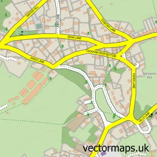
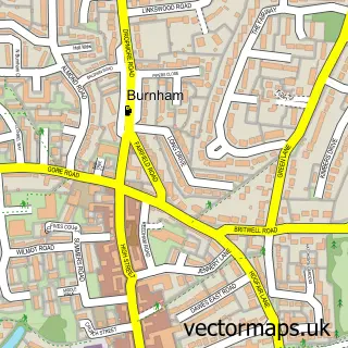
This Cookham street map is a detailed vector street map covering a 750m x 750m area. Select a larger area to create and download your own vector street map of Cookham.
The 750-metre map sample for Cookham covers 176 mapped buildings and approximately 10.0 km of road detail, of which 11 named roads are named. The immediate area includes 1 school, 1 GP surgery within 2 miles, 8 pubs and 1 MOT station, with 6 within 2 miles. The wider area around Cookham features 1 tourism point of interest, 11 food and drink venues and 4 hotels. To create a larger or custom map of Cookham, the map builder lets you define your own coverage area and download editable SVG, PDF and PNG files.
Create a larger editable map of Cookham
Choose any area you need and generate a high-quality vector map instantly. Perfect for print, planning, design, business and personal use.

This Cookham street map in Berkshire is available as downloadable SVG, PDF and PNG map files, or as a printed map for planning, business, display, education, local information and design work. You can also create a larger custom map area using the map selector.
What this Cookham map sample shows
Cookham lies within Cookham Cp parish, part of Bisham & Cookham ward in the Windsor And Maidenhead (B) local authority area. The postcode geography for this area includes the SL postcode area, the SL6 postcode district and the SL6 9 postcode sector. Residents fall under the Nhs Frimley Integrated Care Board for NHS services.
Local features near Cookham
Within 2 milesAmenities and services in and around Cookham.
Administrative and postcode information for Cookham
The local authority covering Cookham is Windsor And Maidenhead (B), within the county of Berkshire. The settlement lies within Bisham & Cookham ward and Cookham Cp civil parish. The SL6 postcode district and SL6 9 postcode sector serve the immediate area. NHS provision in the area is delivered through Frimley Health Nhs Foundation Trust.
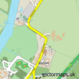
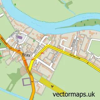
Nearby street map samples around Cookham

More street maps in Berkshire
750 metre map area coverage
Boundary, postcode and point of interest information for the 750m x 750m rectangle centred on this sample map.
Boundaries containing map centre
Constituency: Maidenhead Co Const
District: Windsor and Maidenhead (B)
Icb: NHS Frimley ICB
Parish: Cookham CP
Police Force: thames valley
Postcode District: SL6
Postcode Sector: SL6 9
Ward: Bisham & Cookham Ward
Nearby boundaries intersecting sample
Constituency: Beaconsfield Co Const
District: Buckinghamshire
Icb: NHS Thames Valley ICB
Parish: Wooburn CP
Postcode District: SL8
Postcode Sector: SL8 5
Ward: Flackwell Heath & The Wooburns Ward
Postcode coverage
POI category counts
Pub: 8
Hair Salon: 5
Hotel: 4
Indian Restaurant: 4
Beauty Salon: 3
Anglican Church: 2
Barber: 2
Beauty And Spa: 2
Brake Service And Repair: 2
Cafe: 2
Sample points of interest
- Odney Country Club, Cookham, Berkshire
- Started From Scratch Online Marketing
- Cookham: Holy Trinity
- Holy Trinity Church
- Stanley Spencer Gallery
- The Stanley Spencer Gallery
- Cookham Festival
- Hamilton House Medical
- Car Finance 4 You
- Forge Motor Co Ltd
- Ross Poole Cookham
- Top Class Turkish Barber
Create a larger editable map of Cookham
This sample shows only a 750 metre area. To create a larger map of Cookham, use our map builder to choose your own coverage area, add titles and download editable SVG, PDF and PNG files.
Create a custom map of Cookham