Vector Maps logo
Home Why it works Popular maps Districts Samples Customizer Create Your Map
VectorMaps.uk
Home Popular maps Districts Samples Customizer Create Your Map Privacy Disclaimer
Home / UK Maps / Gloucestershire / Bourton-on-the-Water Map

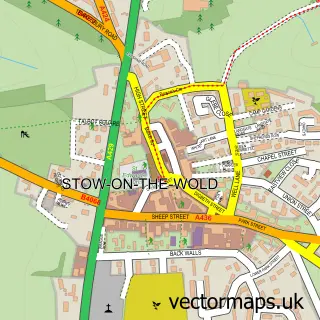
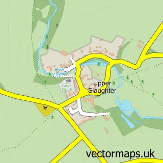
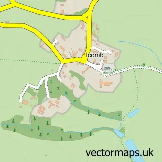
This Bourton-on-the-Water street map is a detailed vector street map covering a 750m x 750m area. Select a larger area to create and download your own vector street map of Bourton-on-the-Water.

Bourton-on-the-Water is a village in Gloucestershire, in the South West of England. The settlement falls within the The Cotswolds parliamentary constituency. It is served by the GL54 postcode district, with GL54 2 as the local postcode sector.

The 750-metre map sample for Bourton-on-the-Water covers 360 mapped buildings and approximately 29.2 km of road detail, of which 23 named roads are named. The immediate area includes 1 school, 1 GP surgery, 6 pubs and 1 MOT station within 2 miles. The wider area around Bourton-on-the-Water features 9 tourism points of interest, 22 food and drink venues and 10 hotels. To create a larger or custom map of Bourton-on-the-Water, the map builder lets you define your own coverage area and download editable SVG, PDF and PNG files.

360Buildings
29.19 kmRoads
23Named roads
2,301Residents within 2 miles
Create your own

Create a larger editable map of Bourton-on-the-Water

Choose any area you need and generate a high-quality vector map instantly. Perfect for print, planning, design, business and personal use.

Choose any location
Editable SVG files
Any size up to A0
PDF, PNG & more
Instant download
High quality guaranteed
Create My Custom Map
Secure, private & no credit card required
Bourton-on-the-Water Vector Street Map
750m Sample
Bourton-on-the-Water vector street map sample showing roads, buildings and local features in a 750 metre preview area
Buy Bourton-on-the-Water Map Print from £12.95 Buy Bourton-on-the-Water Digital Map from £6

This Bourton-on-the-Water street map in Gloucestershire is available as downloadable SVG, PDF and PNG map files, or as a printed map for planning, business, display, education, local information and design work. You can also create a larger custom map area using the map selector.

What this Bourton-on-the-Water map sample shows

Bourton-on-the-Water lies within Bourton-On-The-Water Cp parish, part of Bourton Village ward in the Cotswold District local authority area. The postcode geography for this area includes the GL postcode area, the GL54 postcode district and the GL54 2 postcode sector. Residents fall under the Nhs Gloucestershire Integrated Care Board for NHS services.

Local features near Bourton-on-the-Water

Within 2 miles

Amenities and services in and around Bourton-on-the-Water.

1 Schools
1 Campsites within 2 miles
1 GP surgeries 1 within 2 miles
1 MOT stations within 2 miles
9 Tourism & leisure
22 Food & drink
6 Pubs
10 Hotels
7 Healthcare POIs
3 Vehicle services

Counts are approximate and based on publicly available data.

Administrative and postcode information for Bourton-on-the-Water

Bourton-on-the-Water lies within Bourton-On-The-Water Cp parish, part of Bourton Village ward in the Cotswold District local authority area. The postcode geography for this area includes the GL postcode area, the GL54 postcode district and the GL54 2 postcode sector. Residents fall under the Nhs Gloucestershire Integrated Care Board for NHS services.

Parish Bourton-on-the-Water CP
Ward Bourton Village
District / local authority Cotswold District
County Gloucestershire
Historic county Gloucestershire
Postcode district GL54
Postcode sector GL54 2
Parliamentary constituency The Cotswolds
Region South West
Country England

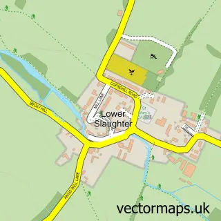
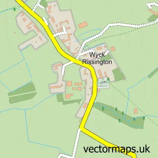
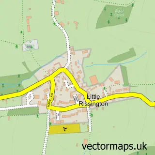
Nearby street map samples around Bourton-on-the-Water

Street map sample of Stow-on-the-Wold, Gloucestershire Stow-on-the-Wold Town - Gloucestershire - 3.5 miles Street map sample of Gloucester, Gloucestershire Gloucester City - Gloucestershire - 20.9 miles Street map sample of Lower Slaughter, Gloucestershire Lower Slaughter Village - Gloucestershire - 1.3 miles Street map sample of Wyck Rissington, Gloucestershire Wyck Rissington Village - Gloucestershire - 1.5 miles Street map sample of Little Rissington, Gloucestershire Little Rissington Village - Gloucestershire - 1.6 miles Street map sample of Upper Slaughter, Gloucestershire Upper Slaughter Village - Gloucestershire - 1.8 miles Street map sample of Upper Rissington, Gloucestershire Upper Rissington Village - Gloucestershire - 2.3 miles Street map sample of Cold Aston, Gloucestershire Cold Aston Village - Gloucestershire - 2.5 miles Street map sample of Great Rissington, Gloucestershire Great Rissington Village - Gloucestershire - 2.9 miles Street map sample of Icomb, Gloucestershire Icomb Village - Gloucestershire - 3.0 miles

More street maps in Gloucestershire

Street map sample of Lower Slaughter, Gloucestershire Lower Slaughter Village - 1.3 miles Street map sample of Wyck Rissington, Gloucestershire Wyck Rissington Village - 1.5 miles Street map sample of Little Rissington, Gloucestershire Little Rissington Village - 1.6 miles Street map sample of Upper Slaughter, Gloucestershire Upper Slaughter Village - 1.8 miles Street map sample of Upper Rissington, Gloucestershire Upper Rissington Village - 2.3 miles

750 metre map area coverage

Boundary, postcode and point of interest information for the 750m x 750m rectangle centred on this sample map.

Boundaries containing map centre

Constituency: North Cotswolds Co Const

County: Gloucestershire County

District: Cotswold District

Icb: NHS Gloucestershire ICB

Parish: Bourton-on-the-Water CP

Police Force: gloucestershire

Postcode District: GL54

Postcode Sector: GL54 2

Ward: Bourton Village Ward

Nearby boundaries intersecting sample

Ward: Bourton Vale Ward

Postcode coverage

GL54 GL54 2

POI category counts

Cafe: 10

Hotel: 10

Bed And Breakfast: 9

Flowers And Gifts Shop: 8

Pub: 6

Holiday Rental Home: 5

Tea Room: 5

Clothing Store: 4

Coffee Shop: 4

Antique Store: 3

Sample points of interest

  • HF Holidays Accommodation
  • The Dragonfly Maze Active Life
  • Cotswold Osteopaths Alternative Medicine
  • St Lawrence Anglican Church
  • Cotswold Antiques and Tea Room Antique Store
  • Sue Ryder Care Antique Store
  • The Looking Glass Antique Store
  • R. A. Bennett & Partners Apartments
  • Picturesque Art Gallery
  • Bourton Basket Arts And Crafts
  • Cotswold Pottery Arts And Crafts
  • Abbeyfield, Alistair Robertson House Assisted Living Facility

Create a larger editable map of Bourton-on-the-Water

This sample shows only a 750 metre area. To create a larger map of Bourton-on-the-Water, use our map builder to choose your own coverage area, add titles and download editable SVG, PDF and PNG files.

Create a custom map of Bourton-on-the-Water

Phone 01751 473136 | Copyright Vectormaps.uk 2026

Samples Customizer Privacy Disclaimer
Bourton-on-the-Water Vector Street Map
Bourton-on-the-Water enlarged street map sample showing a 750 metre preview area