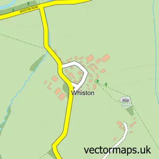
This Brafield-on-the-Green street map is a detailed vector street map covering a 750m x 750m area. Select a larger area to create and download your own vector street map of Brafield-on-the-Green.
The 750-metre map sample for Brafield-on-the-Green covers 184 mapped buildings and approximately 13.0 km of road detail, of which 13 named roads are named. The immediate area includes 1 GP surgery within 2 miles, 1 pub and 3 MOT stations within 2 miles. The wider area around Brafield-on-the-Green features 1 food and drink venue and 1 campsite within 2 miles. To create a larger or custom map of Brafield-on-the-Green, the map builder lets you define your own coverage area and download editable SVG, PDF and PNG files.
Create a larger editable map of Brafield-on-the-Green
Choose any area you need and generate a high-quality vector map instantly. Perfect for print, planning, design, business and personal use.

This Brafield-on-the-Green street map in Northamptonshire is available as downloadable SVG, PDF and PNG map files, or as a printed map for planning, business, display, education, local information and design work. You can also create a larger custom map area using the map selector.
What this Brafield-on-the-Green map sample shows
Brafield-on-the-Green lies within Brafield On The Green Cp parish, part of Brafield And Yardley ward in the West Northamptonshire local authority area. The postcode geography for this area includes the NN postcode area, the NN7 postcode district and the NN7 1 postcode sector. Residents fall under the Nhs Northamptonshire Integrated Care Board for NHS services.
Local features near Brafield-on-the-Green
Within 2 milesAmenities and services in and around Brafield-on-the-Green.
Administrative and postcode information for Brafield-on-the-Green
The local authority covering Brafield-on-the-Green is West Northamptonshire, within the county of Northamptonshire. The settlement lies within Brafield And Yardley ward and Brafield On The Green Cp civil parish. The NN7 postcode district and NN7 1 postcode sector serve the immediate area. NHS provision in the area is delivered through Northampton General Hospital Nhs Trust.
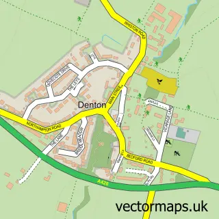
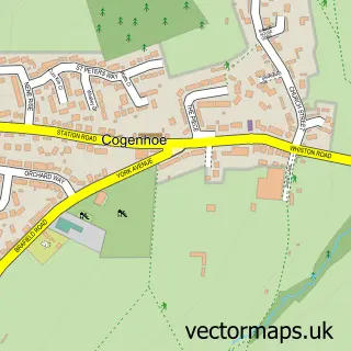
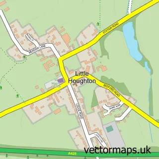
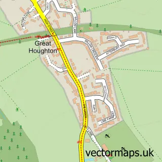
Nearby street map samples around Brafield-on-the-Green


More street maps in Northamptonshire
750 metre map area coverage
Boundary, postcode and point of interest information for the 750m x 750m rectangle centred on this sample map.
Boundaries containing map centre
Constituency: South Northamptonshire Co Const
District: West Northamptonshire
Icb: NHS Northamptonshire ICB
Parish: Brafield on the Green CP
Police Force: northamptonshire
Postcode District: NN7
Postcode Sector: NN7 1
Ward: Cogenhoe & The Houghtons Ward
Nearby boundaries intersecting sample
No additional intersecting boundaries found.
Postcode coverage
POI category counts
Shipping Center: 2
Anglican Church: 1
Building Supply Store: 1
Butcher Shop: 1
Caterer: 1
Church Cathedral: 1
Currency Exchange: 1
Elementary School: 1
Event Technology Service: 1
Financial Advising: 1
Sample points of interest
- St Laurence
- Tj Barden Roofing Services
- Top joint butchers
- Go Cater
- St Laurence Church Brafield on the Green
- Post Office Travel Money
- Acorn Day Nursery
- TJS Marquees
- Belmont Associates
- B Hollowell and Son
- Pace
- Acorn Childcare at Brafield
Create a larger editable map of Brafield-on-the-Green
This sample shows only a 750 metre area. To create a larger map of Brafield-on-the-Green, use our map builder to choose your own coverage area, add titles and download editable SVG, PDF and PNG files.
Create a custom map of Brafield-on-the-Green