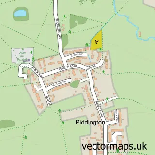
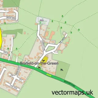
This Hackleton street map is a detailed vector street map covering a 750m x 750m area. Select a larger area to create and download your own vector street map of Hackleton.
The 750-metre map sample for Hackleton covers 206 mapped buildings and approximately 15.4 km of road detail, of which 18 named roads are named. The immediate area includes 1 pub. The wider area around Hackleton features 1 tourism point of interest and 2 food and drink venues. To create a larger or custom map of Hackleton, the map builder lets you define your own coverage area and download editable SVG, PDF and PNG files.
Create a larger editable map of Hackleton
Choose any area you need and generate a high-quality vector map instantly. Perfect for print, planning, design, business and personal use.

This Hackleton street map in Northamptonshire is available as downloadable SVG, PDF and PNG map files, or as a printed map for planning, business, display, education, local information and design work. You can also create a larger custom map area using the map selector.
What this Hackleton map sample shows
Hackleton lies within Hackleton Cp parish, part of Hackleton ward in the West Northamptonshire local authority area. The postcode geography for this area includes the NN postcode area, the NN7 postcode district and the NN7 2 postcode sector. Residents fall under the Nhs Northamptonshire Integrated Care Board for NHS services.
Local features near Hackleton
Within 2 milesAmenities and services in and around Hackleton.
Administrative and postcode information for Hackleton
Hackleton lies within Hackleton Cp parish, part of Hackleton ward in the West Northamptonshire local authority area. The postcode geography for this area includes the NN postcode area, the NN7 postcode district and the NN7 2 postcode sector. Residents fall under the Nhs Northamptonshire Integrated Care Board for NHS services.
Nearby street map samples around Hackleton


More street maps in Northamptonshire
750 metre map area coverage
Boundary, postcode and point of interest information for the 750m x 750m rectangle centred on this sample map.
Boundaries containing map centre
Constituency: South Northamptonshire Co Const
District: West Northamptonshire
Icb: NHS Northamptonshire ICB
Parish: Hackleton CP
Police Force: northamptonshire
Postcode District: NN7
Postcode Sector: NN7 2
Ward: Hackleton & Roade Ward
Nearby boundaries intersecting sample
No additional intersecting boundaries found.
Postcode coverage
POI category counts
Construction Services: 2
Engine Repair Service: 2
Post Office: 2
Art Museum: 1
Baptist Church: 1
Building Supply Store: 1
Coffee Shop: 1
Community Center: 1
Key And Locksmith: 1
Land Surveying: 1
Sample points of interest
- Upper Nene Archaeological Society
- Hackleton Baptist Church
- CFT Plumbing Solutions
- Coffee at Carey
- Hackleton Village Hall
- LUX Construction Group
- Lux Developments
- Fensome Locksmith
- Fensome Locksmiths
- Attend-A-Lock
- Bhangals Construction Consultants
- Austin Investigations
Create a larger editable map of Hackleton
This sample shows only a 750 metre area. To create a larger map of Hackleton, use our map builder to choose your own coverage area, add titles and download editable SVG, PDF and PNG files.
Create a custom map of Hackleton