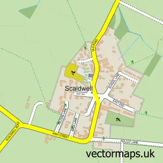
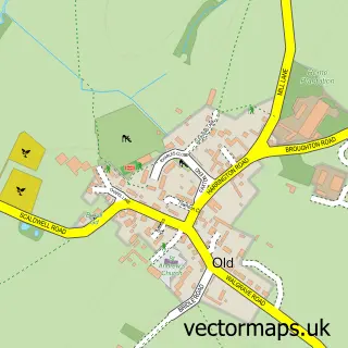
This Brixworth street map is a detailed vector street map covering a 750m x 750m area. Select a larger area to create and download your own vector street map of Brixworth.
The 750-metre map sample for Brixworth covers 497 mapped buildings and approximately 40.3 km of road detail, of which 41 named roads are named. The immediate area includes 2 pubs and 1 MOT station, with 2 within 2 miles. The wider area around Brixworth features 7 food and drink venues and 1 hotel. To create a larger or custom map of Brixworth, the map builder lets you define your own coverage area and download editable SVG, PDF and PNG files.
Create a larger editable map of Brixworth
Choose any area you need and generate a high-quality vector map instantly. Perfect for print, planning, design, business and personal use.

This Brixworth street map in Northamptonshire is available as downloadable SVG, PDF and PNG map files, or as a printed map for planning, business, display, education, local information and design work. You can also create a larger custom map area using the map selector.
What this Brixworth map sample shows
Brixworth lies within Brixworth Cp parish, part of Brixworth ward in the West Northamptonshire local authority area. The postcode geography for this area includes the NN postcode area, the NN6 postcode district and the NN6 9 postcode sector. Residents fall under the Nhs Northamptonshire Integrated Care Board for NHS services.
Local features near Brixworth
Within 2 milesAmenities and services in and around Brixworth.
Administrative and postcode information for Brixworth
Brixworth lies within Brixworth Cp parish, part of Brixworth ward in the West Northamptonshire local authority area. The postcode geography for this area includes the NN postcode area, the NN6 postcode district and the NN6 9 postcode sector. Residents fall under the Nhs Northamptonshire Integrated Care Board for NHS services.
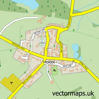
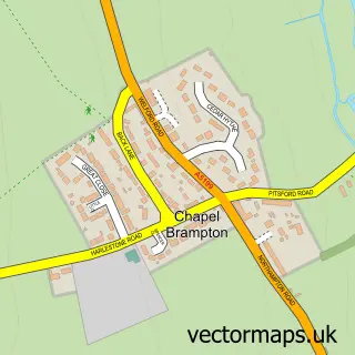
Nearby street map samples around Brixworth


More street maps in Northamptonshire
750 metre map area coverage
Boundary, postcode and point of interest information for the 750m x 750m rectangle centred on this sample map.
Boundaries containing map centre
Constituency: Daventry Co Const
District: West Northamptonshire
Icb: NHS Northamptonshire ICB
Parish: Brixworth CP
Police Force: northamptonshire
Postcode District: NN6
Postcode Sector: NN6 9
Ward: Brixworth Ward
Nearby boundaries intersecting sample
No additional intersecting boundaries found.
Postcode coverage
POI category counts
Software Development: 4
Cafe: 3
Grocery Store: 3
Preschool: 3
Professional Services: 3
Auto Body Shop: 2
Automotive: 2
Automotive Repair: 2
Bakery: 2
Barber: 2
Sample points of interest
- Orange Juice Communications
- CPL Aromas Ltd
- Fuggles Fettling
- Quality Vehicle Refurb
- Clouds Hill Classics
- Brixworth Servicing & Tyre Centre
- Clouds Hill Classics
- Ideal Motors Coach Works
- Spanish Tiles Direct
- Perspective Risk
- Cakery Bay
- Hockley's Cakes
Create a larger editable map of Brixworth
This sample shows only a 750 metre area. To create a larger map of Brixworth, use our map builder to choose your own coverage area, add titles and download editable SVG, PDF and PNG files.
Create a custom map of Brixworth