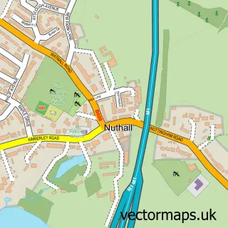
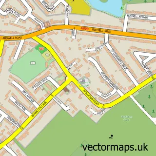
This Bulwell street map is a detailed vector street map covering a 750m x 750m area. Select a larger area to create and download your own vector street map of Bulwell.
The 750-metre map sample for Bulwell covers 448 mapped buildings and approximately 31.9 km of road detail, of which 58 named roads are named. The immediate area includes 1 railway station, 2 GP surgeries, with 11 within 2 miles, 9 pubs and 4 MOT stations, with 26 within 2 miles. The wider area around Bulwell features 3 tourism points of interest and 18 food and drink venues. To create a larger or custom map of Bulwell, the map builder lets you define your own coverage area and download editable SVG, PDF and PNG files.
Create a larger editable map of Bulwell
Choose any area you need and generate a high-quality vector map instantly. Perfect for print, planning, design, business and personal use.

This Bulwell street map in Nottinghamshire is available as downloadable SVG, PDF and PNG map files, or as a printed map for planning, business, display, education, local information and design work. You can also create a larger custom map area using the map selector.
What this Bulwell map sample shows
Bulwell lies within City Of Nottingham (B) parish, part of Bulwell ward in the City Of Nottingham (B) local authority area. The postcode geography for this area includes the NG postcode area, the NG6 postcode district and the NG6 8 postcode sector. Residents fall under the Nhs Nottingham And Nottinghamshire Integrated Care Board for NHS services.
Local features near Bulwell
Within 2 milesAmenities and services in and around Bulwell.
Administrative and postcode information for Bulwell
Bulwell lies within City Of Nottingham (B) parish, part of Bulwell ward in the City Of Nottingham (B) local authority area. The postcode geography for this area includes the NG postcode area, the NG6 postcode district and the NG6 8 postcode sector. Residents fall under the Nhs Nottingham And Nottinghamshire Integrated Care Board for NHS services.
Nearby street map samples around Bulwell


More street maps in Nottinghamshire
750 metre map area coverage
Boundary, postcode and point of interest information for the 750m x 750m rectangle centred on this sample map.
Boundaries containing map centre
Constituency: Nottingham North and Kimberley Boro Const
District: City of Nottingham (B)
Icb: NHS Nottingham and Nottinghamshire ICB
Police Force: nottinghamshire
Postcode District: NG6
Postcode Sector: NG6 8
Ward: Bulwell Ward
Nearby boundaries intersecting sample
Postcode Sector: NG6 9
Ward: Bulwell Forest Ward
Postcode coverage
POI category counts
Pub: 9
Automotive Repair: 8
Beauty Salon: 7
Cafe: 6
Hair Salon: 6
Supermarket: 6
Bank Credit Union: 5
Charity Organization: 5
Doctor: 5
Fast Food Restaurant: 5
Sample points of interest
- BCS College
- Illustrative Sponge
- Nosh-Afrik restaurant
- Admiral Casino: Bulwell Main Street
- Sun Valley Amusements
- St Mary the Virgin & All Souls' Church, Bulwell
- Cancer Research UK
- Marie Curie Charity Shop
- Bee Domestic Appliances
- The Moon & Stars
- Highfield Nursing Home
- Cashpoint® 233-235 Main Street
Create a larger editable map of Bulwell
This sample shows only a 750 metre area. To create a larger map of Bulwell, use our map builder to choose your own coverage area, add titles and download editable SVG, PDF and PNG files.
Create a custom map of Bulwell