Vector Maps logo
Home Why it works Popular maps Districts Samples Customizer Create Your Map
VectorMaps.uk
Home Popular maps Districts Samples Customizer Create Your Map Privacy Disclaimer
Home / UK Maps / Stirling and Falkirk / Cambuskenneth Map

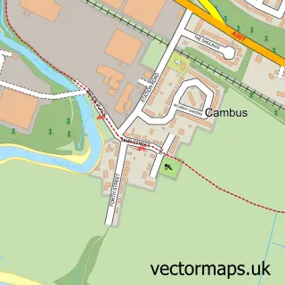
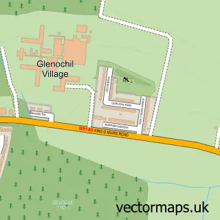
This Cambuskenneth street map is a detailed vector street map covering a 750m x 750m area. Select a larger area to create and download your own vector street map of Cambuskenneth.

Cambuskenneth is a village in Stirling And Falkirk, in the Mid Scotland And Fife of Scotland. Historically, the area formed part of Stirlingshire. The settlement falls within the Stirling parliamentary constituency. It is served by the FK9 postcode distri

The 750-metre map sample for Cambuskenneth covers 147 mapped buildings and approximately 8.2 km of road detail, of which 16 named roads are named. The immediate area includes 7 GP surgeries within 2 miles and 17 MOT stations within 2 miles. The wider area around Cambuskenneth features 3 tourism points of interest and 1 campsite within 2 miles. To create a larger or custom map of Cambuskenneth, the map builder lets you define your own coverage area and download editable SVG, PDF and PNG files.

147Buildings
8.17 kmRoads
16Named roads
0Residents within 2 miles
Create your own

Create a larger editable map of Cambuskenneth

Choose any area you need and generate a high-quality vector map instantly. Perfect for print, planning, design, business and personal use.

Choose any location
Editable SVG files
Any size up to A0
PDF, PNG & more
Instant download
High quality guaranteed
Create My Custom Map
Secure, private & no credit card required
Cambuskenneth Vector Street Map
750m Sample
Cambuskenneth vector street map sample showing roads, buildings and local features in a 750 metre preview area
Buy Cambuskenneth Map Print from £12.95 Buy Cambuskenneth Digital Map from £6

This Cambuskenneth street map in Stirling and Falkirk is available as downloadable SVG, PDF and PNG map files, or as a printed map for planning, business, display, education, local information and design work. You can also create a larger custom map area using the map selector.

What this Cambuskenneth map sample shows

Cambuskenneth lies within Stirling parish, part of Stirling North ward in the Stirling local authority area. The postcode geography for this area includes the FK postcode area, the FK9 postcode district and the FK9 5 postcode sector. Residents fall under the Forth Valley for NHS services.

Local features near Cambuskenneth

Within 2 miles

Amenities and services in and around Cambuskenneth.

1 Campsites within 2 miles
7 GP surgeries within 2 miles
17 MOT stations within 2 miles
3 Tourism & leisure

Counts are approximate and based on publicly available data.

Administrative and postcode information for Cambuskenneth

Cambuskenneth lies within Stirling parish, part of Stirling North ward in the Stirling local authority area. The postcode geography for this area includes the FK postcode area, the FK9 postcode district and the FK9 5 postcode sector. Residents fall under the Forth Valley for NHS services.

Parish STIRLING
Ward Stirling North
District / local authority Stirling
County Stirling and Falkirk
Historic county Stirlingshire
Postcode district FK9
Postcode sector FK9 5
Parliamentary constituency Stirling
Region Mid Scotland and Fife
Country Scotland

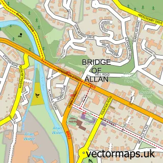
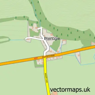
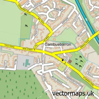
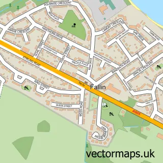
Nearby street map samples around Cambuskenneth

Street map sample of Bridge of Allan, Stirling and Falkirk Bridge of Allan Town - Stirling and Falkirk - 2.3 miles Street map sample of Stirling, Stirling and Falkirk Stirling City - Stirling and Falkirk - 0.8 miles Street map sample of Blairlogie, Stirling and Falkirk Blairlogie Village - Stirling and Falkirk - 2.1 miles Street map sample of Cambusbarron, Stirling and Falkirk Cambusbarron Village - Stirling and Falkirk - 2.1 miles Street map sample of Fallin, Stirling and Falkirk Fallin Village - Stirling and Falkirk - 2.3 miles Street map sample of Cambus, Clackmannan Cambus Village - Clackmannan - 3.0 miles Street map sample of Menstrie, Clackmannan Menstrie Village - Clackmannan - 3.1 miles Street map sample of Throsk, Stirling and Falkirk Throsk Village - Stirling and Falkirk - 3.4 miles Street map sample of Cowie, Stirling and Falkirk Cowie Village - Stirling and Falkirk - 3.6 miles Street map sample of Glenochil, Clackmannan Glenochil Village - Clackmannan - 4.2 miles

More street maps in Stirling and Falkirk

Street map sample of Stirling, Stirling and Falkirk Stirling City - 0.8 miles Street map sample of Blairlogie, Stirling and Falkirk Blairlogie Village - 2.1 miles Street map sample of Cambusbarron, Stirling and Falkirk Cambusbarron Village - 2.1 miles Street map sample of Fallin, Stirling and Falkirk Fallin Village - 2.3 miles Street map sample of Bridge of Allan, Stirling and Falkirk Bridge of Allan Town - 2.3 miles

750 metre map area coverage

Boundary, postcode and point of interest information for the 750m x 750m rectangle centred on this sample map.

Boundaries containing map centre

Constituency: Stirling and Strathallan Co Const

District: Stirling

Icb: Forth Valley

Postcode District: FK9

Postcode Sector: FK9 5

Ward: Stirling North Ward

Nearby boundaries intersecting sample

Postcode District: FK8

Postcode Sector: FK8 1

Ward: Stirling East Ward

Postcode coverage

FK9 FK9 5 FK8 FK8 1

POI category counts

Carpenter: 2

Landmark And Historical Building: 2

Roofing: 2

Convents And Monasteries: 1

Electrician: 1

Energy Company: 1

Graphic Designer: 1

Health And Medical: 1

Park: 1

Pet Breeder: 1

Sample points of interest

  • Dawson Bespoke Joinery Carpenter
  • J & I Brodie Carpenter
  • Abbaye de Cambuskenneth Convents And Monasteries
  • Ochilvale Engineering Electrician
  • Connected Kerb Charging Station Energy Company
  • Four Trees Design Co Graphic Designer
  • Aesthetica Stirling Health And Medical
  • Cambuskenneth Abbey Landmark And Historical Building
  • Stirling Luxury Apartments Landmark And Historical Building
  • Riverside Park Park
  • Glenauld Boxers & Boston Terriers Pet Breeder
  • Cambuskenneth Play Park Playground

Create a larger editable map of Cambuskenneth

This sample shows only a 750 metre area. To create a larger map of Cambuskenneth, use our map builder to choose your own coverage area, add titles and download editable SVG, PDF and PNG files.

Create a custom map of Cambuskenneth

Phone 01751 473136 | Copyright Vectormaps.uk 2026

Samples Customizer Privacy Disclaimer
Cambuskenneth Vector Street Map
Cambuskenneth enlarged street map sample showing a 750 metre preview area