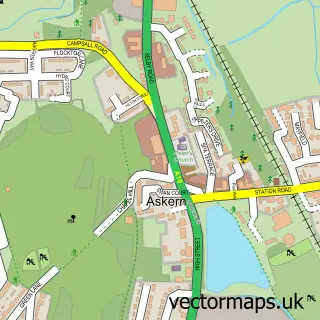
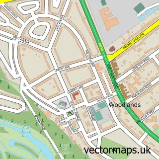
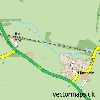
This Carcroft street map is a detailed vector street map covering a 750m x 750m area. Select a larger area to create and download your own vector street map of Carcroft.
The 750-metre map sample for Carcroft covers 274 mapped buildings and approximately 11.2 km of road detail, of which 22 named roads are named. The immediate area includes 1 GP surgery and 2 MOT stations, with 7 within 2 miles. The wider area around Carcroft features 2 food and drink venues. To create a larger or custom map of Carcroft, the map builder lets you define your own coverage area and download editable SVG, PDF and PNG files.
Create a larger editable map of Carcroft
Choose any area you need and generate a high-quality vector map instantly. Perfect for print, planning, design, business and personal use.

This Carcroft street map in South Yorkshire is available as downloadable SVG, PDF and PNG map files, or as a printed map for planning, business, display, education, local information and design work. You can also create a larger custom map area using the map selector.
What this Carcroft map sample shows
Carcroft lies within Doncaster District (B) parish, part of Adwick Le Street & Carcroft ward in the Doncaster District (B) local authority area. The postcode geography for this area includes the DN postcode area, the DN6 postcode district and the DN6 8 postcode sector. Residents fall under the Nhs South Yorkshire Integrated Care Board for NHS services.
Local features near Carcroft
Within 2 milesAmenities and services in and around Carcroft.
Administrative and postcode information for Carcroft
Carcroft lies within Doncaster District (B) parish, part of Adwick Le Street & Carcroft ward in the Doncaster District (B) local authority area. The postcode geography for this area includes the DN postcode area, the DN6 postcode district and the DN6 8 postcode sector. Residents fall under the Nhs South Yorkshire Integrated Care Board for NHS services.
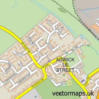
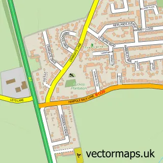
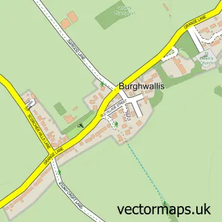
Nearby street map samples around Carcroft

More street maps in South Yorkshire
750 metre map area coverage
Boundary, postcode and point of interest information for the 750m x 750m rectangle centred on this sample map.
Boundaries containing map centre
Constituency: Doncaster North Co Const
District: Doncaster District (B)
Icb: NHS South Yorkshire ICB
Police Force: south yorkshire
Postcode District: DN6
Postcode Sector: DN6 8
Ward: Adwick le Street & Carcroft Ward
Nearby boundaries intersecting sample
No additional intersecting boundaries found.
Postcode coverage
POI category counts
Doctor: 3
Industrial Equipment: 3
Pharmacy: 3
Professional Services: 3
Supermarket: 3
Auction House: 2
Beauty Salon: 2
Cafe: 2
Church Cathedral: 2
Furniture Store: 2
Sample points of interest
- Little Fish Accountants
- OnSigns
- St Michael & All Angels
- Arundell Veterinary Care
- Tudor Auction Rooms Ltd
- UK & EUROPEAN AUCTIONS ltd
- Clarks Vehicle Conversions
- A2B Recovery Services of Doncaster
- Diagraph Transport Supplies
- Bullcroft Car Care Centre
- CBT & D a S Motorcycle Training School
- New Street Kitchen
Create a larger editable map of Carcroft
This sample shows only a 750 metre area. To create a larger map of Carcroft, use our map builder to choose your own coverage area, add titles and download editable SVG, PDF and PNG files.
Create a custom map of Carcroft