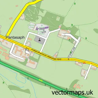
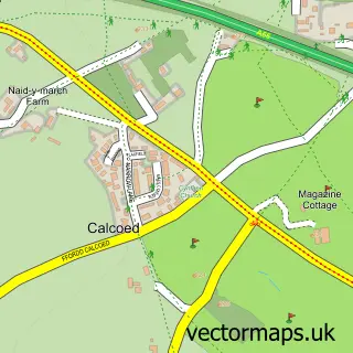
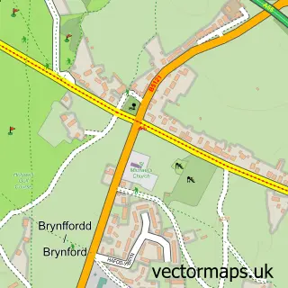
This Carmel street map is a detailed vector street map covering a 750m x 750m area. Select a larger area to create and download your own vector street map of Carmel.
The 750-metre map sample for Carmel covers 140 mapped buildings and approximately 9.6 km of road detail, of which 6 named roads are named. The immediate area includes 1 school, 1 pub and 4 MOT stations within 2 miles. The wider area around Carmel features 1 tourism point of interest and 1 food and drink venue. To create a larger or custom map of Carmel, the map builder lets you define your own coverage area and download editable SVG, PDF and PNG files.
Create a larger editable map of Carmel
Choose any area you need and generate a high-quality vector map instantly. Perfect for print, planning, design, business and personal use.

This Carmel street map in Clwyd is available as downloadable SVG, PDF and PNG map files, or as a printed map for planning, business, display, education, local information and design work. You can also create a larger custom map area using the map selector.
What this Carmel map sample shows
Carmel lies within Whitford Community parish, part of Whitford ward in the Sir Y Fflint - Flintshire local authority area. The postcode geography for this area includes the CH postcode area, the CH8 postcode district and the CH8 8 postcode sector. Residents fall under the Betsi Cadwaladr University Health Board for NHS services.
Local features near Carmel
Within 2 milesAmenities and services in and around Carmel.
Administrative and postcode information for Carmel
Carmel lies within Whitford Community parish, part of Whitford ward in the Sir Y Fflint - Flintshire local authority area. The postcode geography for this area includes the CH postcode area, the CH8 postcode district and the CH8 8 postcode sector. Residents fall under the Betsi Cadwaladr University Health Board for NHS services.
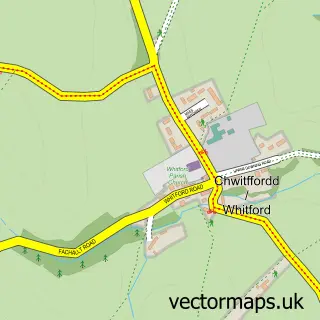
Nearby street map samples around Carmel

More street maps in Clwyd
750 metre map area coverage
Boundary, postcode and point of interest information for the 750m x 750m rectangle centred on this sample map.
Boundaries containing map centre
Constituency: Clwyd East Co Const
District: Sir y Fflint - Flintshire
Icb: Betsi Cadwaladr University
Parish: Whitford Community
Police Force: north wales
Postcode District: CH8
Postcode Sector: CH8 8
Nearby boundaries intersecting sample
Postcode Sector: CH8 9
Postcode coverage
POI category counts
Advertising Agency: 1
Attractions And Activities: 1
Automotive Dealer: 1
Bed And Breakfast: 1
Business Management Services: 1
Elementary School: 1
Pub: 1
Public Service And Government: 1
Scout Hall: 1
Sample points of interest
- A J Typesetters
- Carmel Playing Fields
- E and JA Hone LTD
- Celyn Villa Bed and Breakfast
- AJ Typesetters
- Ysgol Bro Carmel County Primary School
- Carmel Village
- Flintshire County Council - Bus Enquiries
- 1st Carmel
Create a larger editable map of Carmel
This sample shows only a 750 metre area. To create a larger map of Carmel, use our map builder to choose your own coverage area, add titles and download editable SVG, PDF and PNG files.
Create a custom map of Carmel