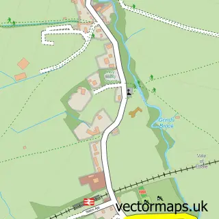
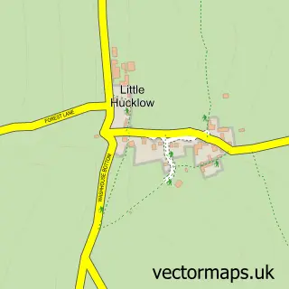
This Castleton street map is a detailed vector street map covering a 750m x 750m area. Select a larger area to create and download your own vector street map of Castleton.
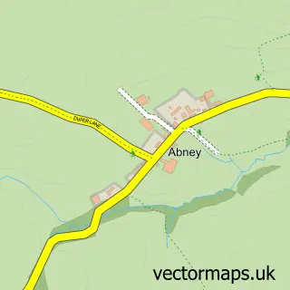
The 750-metre map sample for Castleton covers 208 mapped buildings and approximately 16.2 km of road detail, of which 18 named roads are named. The immediate area includes 1 school, 1 GP surgery within 2 miles, 6 pubs and 2 MOT stations within 2 miles. The wider area around Castleton features 6 tourism points of interest, 11 food and drink venues and 5 hotels. To create a larger or custom map of Castleton, the map builder lets you define your own coverage area and download editable SVG, PDF and PNG files.
Create a larger editable map of Castleton
Choose any area you need and generate a high-quality vector map instantly. Perfect for print, planning, design, business and personal use.

This Castleton street map in Derbyshire is available as downloadable SVG, PDF and PNG map files, or as a printed map for planning, business, display, education, local information and design work. You can also create a larger custom map area using the map selector.
What this Castleton map sample shows
Castleton lies within Castleton Cp parish, part of Hope Valley ward in the High Peak District (B) local authority area. The postcode geography for this area includes the S postcode area, the S33 postcode district and the S33 8 postcode sector. Residents fall under the Nhs Derby And Derbyshire Integrated Care Board for NHS services.
Local features near Castleton
Within 2 milesAmenities and services in and around Castleton.
Administrative and postcode information for Castleton
The local authority covering Castleton is High Peak District (B), within the county of Derbyshire. The settlement lies within Hope Valley ward and Castleton Cp civil parish. The S33 postcode district and S33 8 postcode sector serve the immediate area. NHS provision in the area is delivered through Stockport Nhs Foundation Trust.
Nearby street map samples around Castleton

More street maps in Derbyshire
750 metre map area coverage
Boundary, postcode and point of interest information for the 750m x 750m rectangle centred on this sample map.
Boundaries containing map centre
Constituency: High Peak Co Const
County: Derbyshire County
District: High Peak District (B)
Icb: NHS Derby and Derbyshire ICB
Parish: Castleton CP
Police Force: derbyshire
Postcode District: S33
Postcode Sector: S33 8
Ward: Hope Valley Ward
Nearby boundaries intersecting sample
No additional intersecting boundaries found.
Postcode coverage
POI category counts
Bed And Breakfast: 8
Pub: 6
Hotel: 5
Flowers And Gifts Shop: 4
Tea Room: 4
Cafe: 3
Holiday Rental Home: 3
Jewelry Store: 3
Resort: 3
Castle: 2
Sample points of interest
- Carlton Emporium
- Peveril Stores
- Bargate Cottage Bed & Breakfast
- Causeway House
- Cheshire Mews
- Four Seasons Guest House
- Four Seasons Guesthouse
- Ramblers Rest
- Swiss House
- Swiss House B&B And Bar With Sky & BT
- L Bywater Electrical Services
- Castleton Bus Station
Create a larger editable map of Castleton
This sample shows only a 750 metre area. To create a larger map of Castleton, use our map builder to choose your own coverage area, add titles and download editable SVG, PDF and PNG files.
Create a custom map of Castleton