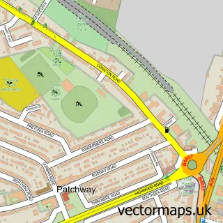
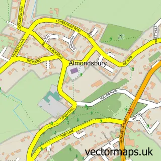
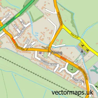
This Catbrain street map is a detailed vector street map covering a 750m x 750m area. Select a larger area to create and download your own vector street map of Catbrain.
The 750-metre map sample for Catbrain covers 161 mapped buildings and approximately 11.1 km of road detail, of which 8 named roads are named. The immediate area includes 2 GP surgeries within 2 miles, 2 pubs and 2 MOT stations, with 18 within 2 miles. The wider area around Catbrain features 1 tourism point of interest, 6 food and drink venues and 4 hotels. To create a larger or custom map of Catbrain, the map builder lets you define your own coverage area and download editable SVG, PDF and PNG files.
Create a larger editable map of Catbrain
Choose any area you need and generate a high-quality vector map instantly. Perfect for print, planning, design, business and personal use.

This Catbrain street map in Gloucestershire is available as downloadable SVG, PDF and PNG map files, or as a printed map for planning, business, display, education, local information and design work. You can also create a larger custom map area using the map selector.
What this Catbrain map sample shows
Catbrain lies within Almondsbury Cp parish, part of Charlton & Cribbs ward in the South Gloucestershire local authority area. The postcode geography for this area includes the BS postcode area, the BS10 postcode district and the BS10 7 postcode sector. Residents fall under the Nhs Bristol, North Somerset And South Gloucestershire Integrated Care Board for NHS services.
Local features near Catbrain
Within 2 milesAmenities and services in and around Catbrain.
Administrative and postcode information for Catbrain
The local authority covering Catbrain is South Gloucestershire, within the county of Gloucestershire. The settlement lies within Charlton & Cribbs ward and Almondsbury Cp civil parish. The BS10 postcode district and BS10 7 postcode sector serve the immediate area. NHS provision in the area is delivered through North Bristol Nhs Trust.
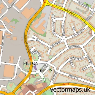
Nearby street map samples around Catbrain

More street maps in Gloucestershire
750 metre map area coverage
Boundary, postcode and point of interest information for the 750m x 750m rectangle centred on this sample map.
Boundaries containing map centre
Constituency: Filton and Bradley Stoke Boro Const
District: South Gloucestershire
Icb: NHS Bristol North Somerset and South Gloucestershire ICB
Parish: Almondsbury CP
Police Force: avon and somerset
Postcode District: BS10
Postcode Sector: BS10 7
Ward: Charlton & Cribbs Ward
Nearby boundaries intersecting sample
Constituency: Thornbury and Yate Co Const
Ward: Pilning & Severn Beach Ward
Postcode coverage
POI category counts
Car Dealer: 12
Ev Charging Station: 6
Automotive: 4
Hotel: 4
Restaurant: 4
Advertising Agency: 2
Auto Body Shop: 2
Carpet Store: 2
Clothing Store: 2
Cosmetic And Beauty Supplies: 2
Sample points of interest
- Next Theme Web Design, SEO, And Digital Marketing
- Next Theme Web Design, SEO, and Digital Marketing
- Dentmagic
- Dentmagic
- Autoglass Bristol
- ACF Car Finance
- Go Skippy
- Goskippy Insurance
- Robins & Day Peugeot Bristol Cribbs Causeway
- Cruickshank Motors Limited
- The Bakers Oven
- Italian Skin Glow
Create a larger editable map of Catbrain
This sample shows only a 750 metre area. To create a larger map of Catbrain, use our map builder to choose your own coverage area, add titles and download editable SVG, PDF and PNG files.
Create a custom map of Catbrain