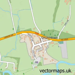
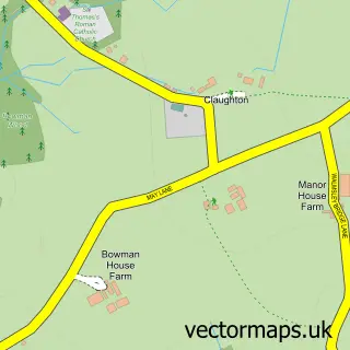
This Catterall street map is a detailed vector street map covering a 750m x 750m area. Select a larger area to create and download your own vector street map of Catterall.
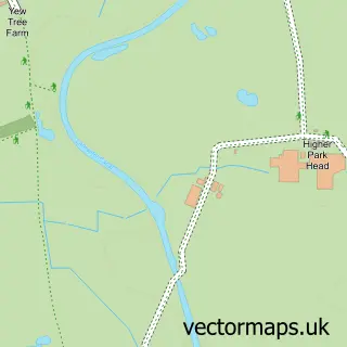
The 750-metre map sample for Catterall covers 638 mapped buildings and approximately 16.6 km of road detail, of which 37 named roads are named. The immediate area includes 1 GP surgery within 2 miles, 1 pub and 2 MOT stations, with 5 within 2 miles. The wider area around Catterall features 3 food and drink venues. To create a larger or custom map of Catterall, the map builder lets you define your own coverage area and download editable SVG, PDF and PNG files.
Create a larger editable map of Catterall
Choose any area you need and generate a high-quality vector map instantly. Perfect for print, planning, design, business and personal use.

This Catterall street map in Lancashire is available as downloadable SVG, PDF and PNG map files, or as a printed map for planning, business, display, education, local information and design work. You can also create a larger custom map area using the map selector.
What this Catterall map sample shows
Catterall lies within Claughton Cp parish, part of Brock With Catterall ward in the Wyre District (B) local authority area. The postcode geography for this area includes the PR postcode area, the PR3 postcode district and the PR3 0 postcode sector. Residents fall under the Nhs Lancashire And South Cumbria Integrated Care Board for NHS services.
Local features near Catterall
Within 2 milesAmenities and services in and around Catterall.
Administrative and postcode information for Catterall
Catterall lies within Claughton Cp parish, part of Brock With Catterall ward in the Wyre District (B) local authority area. The postcode geography for this area includes the PR postcode area, the PR3 postcode district and the PR3 0 postcode sector. Residents fall under the Nhs Lancashire And South Cumbria Integrated Care Board for NHS services.
Nearby street map samples around Catterall

More street maps in Lancashire
750 metre map area coverage
Boundary, postcode and point of interest information for the 750m x 750m rectangle centred on this sample map.
Boundaries containing map centre
Constituency: Lancaster and Wyre Co Const
County: Lancashire County
District: Wyre District (B)
Icb: NHS Lancashire and South Cumbria ICB
Parish: Catterall CP
Police Force: lancashire
Postcode District: PR3
Postcode Sector: PR3 0
Ward: Brock with Catterall Ward
Nearby boundaries intersecting sample
Parish: Claughton CP
Postcode Sector: PR3 1
Postcode coverage
POI category counts
Auction House: 2
Beauty Salon: 2
Building Supply Store: 2
Driving School: 2
Electrician: 2
Italian Restaurant: 2
Welding Supply Store: 2
Agricultural Service: 1
Airport Shuttles: 1
Arts And Entertainment: 1
Sample points of interest
- Clarke and Pulman Ltd
- Airport Transfers Lancashire
- Quadrille Ceilidh Band
- Adam Partridge Auctioneers and Valuers
- Brockholes Arms Auction Mart
- Bode Positioners Ltd
- Clockwork Bars
- Creation Hair Salon
- Voie Hair & Beauty
- KLT Dairies
- Haldane Fisher
- Thomas Gornall Window Cleaners
Create a larger editable map of Catterall
This sample shows only a 750 metre area. To create a larger map of Catterall, use our map builder to choose your own coverage area, add titles and download editable SVG, PDF and PNG files.
Create a custom map of Catterall