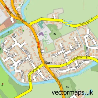
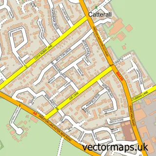
This Garstang street map is a detailed vector street map covering a 750m x 750m area. Select a larger area to create and download your own vector street map of Garstang.
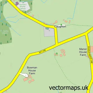
The 750-metre map sample for Garstang covers 320 mapped buildings and approximately 13.9 km of road detail, of which 32 named roads are named. The immediate area includes 1 GP surgery within 2 miles, 14 pubs and 1 MOT station, with 6 within 2 miles. The wider area around Garstang features 1 tourism point of interest, 20 food and drink venues and 1 hotel. To create a larger or custom map of Garstang, the map builder lets you define your own coverage area and download editable SVG, PDF and PNG files.
Create a larger editable map of Garstang
Choose any area you need and generate a high-quality vector map instantly. Perfect for print, planning, design, business and personal use.

This Garstang street map in Lancashire is available as downloadable SVG, PDF and PNG map files, or as a printed map for planning, business, display, education, local information and design work. You can also create a larger custom map area using the map selector.
What this Garstang map sample shows
Garstang lies within Garstang Cp parish, part of Garstang ward in the Wyre District (B) local authority area. The postcode geography for this area includes the PR postcode area, the PR3 postcode district and the PR3 1 postcode sector. Residents fall under the Nhs Lancashire And South Cumbria Integrated Care Board for NHS services.
Local features near Garstang
Within 2 milesAmenities and services in and around Garstang.
Administrative and postcode information for Garstang
The local authority covering Garstang is Wyre District (B), within the county of Lancashire. The settlement lies within Garstang ward and Garstang Cp civil parish. The PR3 postcode district and PR3 1 postcode sector serve the immediate area. NHS provision in the area is delivered through University Hospitals Of Morecambe Bay Nhs Foundation Trust.
Nearby street map samples around Garstang

More street maps in Lancashire
750 metre map area coverage
Boundary, postcode and point of interest information for the 750m x 750m rectangle centred on this sample map.
Boundaries containing map centre
Constituency: Lancaster and Wyre Co Const
County: Lancashire County
District: Wyre District (B)
Icb: NHS Lancashire and South Cumbria ICB
Parish: Garstang CP
Police Force: lancashire
Postcode District: PR3
Postcode Sector: PR3 1
Ward: Garstang Ward
Nearby boundaries intersecting sample
Parish: Barnacre-with-Bonds CP
Ward: Calder Ward
Postcode coverage
POI category counts
Pub: 14
Beauty Salon: 9
Hair Salon: 8
Bank Credit Union: 6
Banks: 6
Flowers And Gifts Shop: 6
Funeral Services And Cemeteries: 6
Barber: 5
Church Cathedral: 5
Dentist: 5
Sample points of interest
- Insight Business Solutions
- Towers and Gornall
- The Acupuncture Lounge
- High Street Card
- Cottage Antiques
- Billingtons
- Graham Anthony Associates
- Artroom Gallery
- Garstang Fine Art
- Nicksons
- Nicksons ltd
- Seeds
Create a larger editable map of Garstang
This sample shows only a 750 metre area. To create a larger map of Garstang, use our map builder to choose your own coverage area, add titles and download editable SVG, PDF and PNG files.
Create a custom map of Garstang