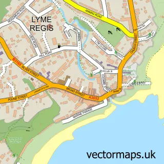
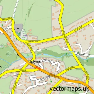
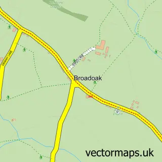
This Charmouth street map is a detailed vector street map covering a 750m x 750m area. Select a larger area to create and download your own vector street map of Charmouth.
The 750-metre map sample for Charmouth covers 396 mapped buildings and approximately 16.7 km of road detail, of which 28 named roads are named. The immediate area includes 1 school and 2 pubs. The wider area around Charmouth features 3 tourism points of interest, 4 food and drink venues and 3 hotels. To create a larger or custom map of Charmouth, the map builder lets you define your own coverage area and download editable SVG, PDF and PNG files.
Create a larger editable map of Charmouth
Choose any area you need and generate a high-quality vector map instantly. Perfect for print, planning, design, business and personal use.

This Charmouth street map in Dorset is available as downloadable SVG, PDF and PNG map files, or as a printed map for planning, business, display, education, local information and design work. You can also create a larger custom map area using the map selector.
What this Charmouth map sample shows
Charmouth lies within Charmouth Cp parish, part of Lyme & Charmouth ward in the Dorset local authority area. The postcode geography for this area includes the DT postcode area, the DT6 postcode district and the DT6 6 postcode sector. Residents fall under the Nhs Dorset Integrated Care Board for NHS services.
Local features near Charmouth
Within 2 milesAmenities and services in and around Charmouth.
Administrative and postcode information for Charmouth
The local authority covering Charmouth is Dorset, within the county of Dorset. The settlement lies within Lyme & Charmouth ward and Charmouth Cp civil parish. The DT6 postcode district and DT6 6 postcode sector serve the immediate area. NHS provision in the area is delivered through Dorset County Hospital Nhs Foundation Trust.
Nearby street map samples around Charmouth

More street maps in Dorset
750 metre map area coverage
Boundary, postcode and point of interest information for the 750m x 750m rectangle centred on this sample map.
Boundaries containing map centre
Constituency: West Dorset Co Const
District: Dorset
Icb: NHS Dorset ICB
Parish: Charmouth CP
Police Force: dorset
Postcode District: DT6
Postcode Sector: DT6 6
Ward: Lyme & Charmouth Ward
Nearby boundaries intersecting sample
Ward: Marshwood Vale Ward
Postcode coverage
POI category counts
Campground: 3
Hotel: 3
Arts And Crafts: 2
Bed And Breakfast: 2
Cafe: 2
Drugstore: 2
Gift Shop: 2
Pub: 2
Web Designer: 2
Acupuncture: 1
Sample points of interest
- Sharp Acupuncture Clinic
- Charmouth: St Andrew
- Diana Parker Ceramics
- Herringbone
- Manor Farm Bar and Takeaway
- Charmouth Bakery
- Sky Bar Charmouth
- The Salon
- Lou T at The Salon
- Hensleigh House
- Hensleigh House Hotel
- The Abbots House
Create a larger editable map of Charmouth
This sample shows only a 750 metre area. To create a larger map of Charmouth, use our map builder to choose your own coverage area, add titles and download editable SVG, PDF and PNG files.
Create a custom map of Charmouth