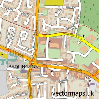
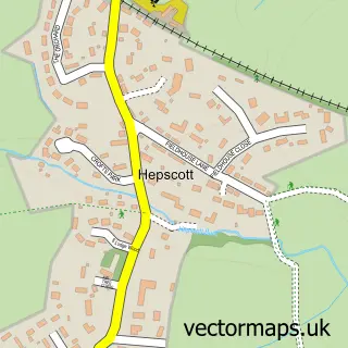
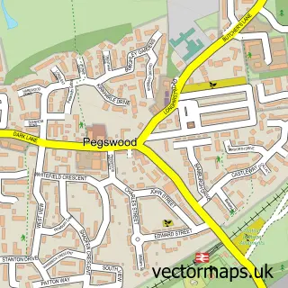
This Choppington street map is a detailed vector street map covering a 750m x 750m area. Select a larger area to create and download your own vector street map of Choppington.
The 750-metre map sample for Choppington covers 81 mapped buildings and approximately 8.0 km of road detail, of which 8 named roads are named. The immediate area includes 3 GP surgeries within 2 miles, 1 pub and 11 MOT stations within 2 miles. The wider area around Choppington features 1 tourism point of interest and 1 food and drink venue. To create a larger or custom map of Choppington, the map builder lets you define your own coverage area and download editable SVG, PDF and PNG files.
Create a larger editable map of Choppington
Choose any area you need and generate a high-quality vector map instantly. Perfect for print, planning, design, business and personal use.

This Choppington street map in Northumberland is available as downloadable SVG, PDF and PNG map files, or as a printed map for planning, business, display, education, local information and design work. You can also create a larger custom map area using the map selector.
What this Choppington map sample shows
Choppington lies within Choppington Cp parish, part of Choppington ward in the Northumberland local authority area. The postcode geography for this area includes the NE postcode area, the NE62 postcode district and the NE62 5 postcode sector. Residents fall under the Nhs North East And North Cumbria Integrated Care Board for NHS services.
Local features near Choppington
Within 2 milesAmenities and services in and around Choppington.
Administrative and postcode information for Choppington
Choppington lies within Choppington Cp parish, part of Choppington ward in the Northumberland local authority area. The postcode geography for this area includes the NE postcode area, the NE62 postcode district and the NE62 5 postcode sector. Residents fall under the Nhs North East And North Cumbria Integrated Care Board for NHS services.
Nearby street map samples around Choppington

More street maps in Northumberland
750 metre map area coverage
Boundary, postcode and point of interest information for the 750m x 750m rectangle centred on this sample map.
Boundaries containing map centre
Constituency: Blyth and Ashington Co Const
District: Northumberland
Icb: NHS North East and North Cumbria ICB
Parish: Choppington CP
Police Force: northumberland
Postcode District: NE62
Postcode Sector: NE62 5
Nearby boundaries intersecting sample
Parish: West Bedlington CP
Postcode coverage
POI category counts
Costume Store: 2
Active Life: 1
Anglican Church: 1
Barbecue Restaurant: 1
Convenience Store: 1
Counseling And Mental Health: 1
Elementary School: 1
Equestrian Facility: 1
Event Planning: 1
Fabric Store: 1
Sample points of interest
- Choppington Woods
- St Paul the Apostle
- The Food Shack
- Premier
- In Disguise Leisure Lines
- In Disguise Leisure Lines Ltd.
- Taylor & Associates Counselling Services
- Choppington Primary School
- Meadow View Equestrian Centre
- Choppington Welfare Centre
- Sheds Of Wool
- Co-op Food
Create a larger editable map of Choppington
This sample shows only a 750 metre area. To create a larger map of Choppington, use our map builder to choose your own coverage area, add titles and download editable SVG, PDF and PNG files.
Create a custom map of Choppington