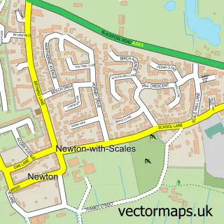
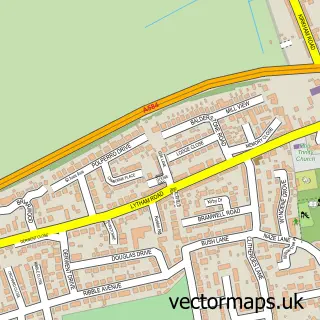
This Clifton street map is a detailed vector street map covering a 750m x 750m area. Select a larger area to create and download your own vector street map of Clifton.
The 750-metre map sample for Clifton covers 285 mapped buildings and approximately 13.5 km of road detail, of which 18 named roads are named. The immediate area includes 1 MOT station, with 3 within 2 miles. The wider area around Clifton features 2 tourism points of interest and 1 food and drink venue. To create a larger or custom map of Clifton, the map builder lets you define your own coverage area and download editable SVG, PDF and PNG files.
Create a larger editable map of Clifton
Choose any area you need and generate a high-quality vector map instantly. Perfect for print, planning, design, business and personal use.

This Clifton street map in Lancashire is available as downloadable SVG, PDF and PNG map files, or as a printed map for planning, business, display, education, local information and design work. You can also create a larger custom map area using the map selector.
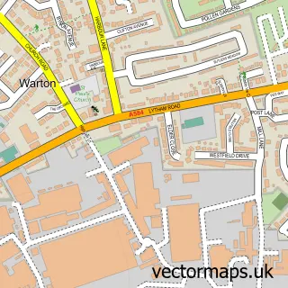
What this Clifton map sample shows
Clifton lies within Newton-With-Clifton Cp parish, part of Newton And Treales ward in the Fylde District (B) local authority area. The postcode geography for this area includes the PR postcode area, the PR4 postcode district and the PR4 0 postcode sector. Residents fall under the Nhs Lancashire And South Cumbria Integrated Care Board for NHS services.
Local features near Clifton
Within 2 milesAmenities and services in and around Clifton.
Administrative and postcode information for Clifton
The local authority covering Clifton is Fylde District (B), within the county of Lancashire. The settlement lies within Newton And Treales ward and Newton-With-Clifton Cp civil parish. The PR4 postcode district and PR4 0 postcode sector serve the immediate area. NHS provision in the area is delivered through Blackpool Teaching Hospitals Nhs Foundation Trust.
Nearby street map samples around Clifton

More street maps in Lancashire
750 metre map area coverage
Boundary, postcode and point of interest information for the 750m x 750m rectangle centred on this sample map.
Boundaries containing map centre
Constituency: Fylde Co Const
County: Lancashire County
District: Fylde District (B)
Icb: NHS Lancashire and South Cumbria ICB
Parish: Newton-with-Clifton CP
Police Force: lancashire
Postcode District: PR4
Postcode Sector: PR4 0
Ward: Rural East Fylde Ward
Nearby boundaries intersecting sample
No additional intersecting boundaries found.
Postcode coverage
POI category counts
Painting: 2
Post Office: 2
Recreational Vehicle Dealer: 2
Auto Company: 1
Automotive Services And Repair: 1
Building Supply Store: 1
Contractor: 1
Fashion Accessories Store: 1
Financial Advising: 1
Gardener: 1
Sample points of interest
- Taylors Garage Ltd
- Fenwick Alloys
- Acer Contracts
- Lightweight Roofing Solutions
- Mcrent
- Matli Asset Management
- Strim Edge Mow
- Lea Gate Service Station
- C-A-Solutions
- Clifton Village, Lancashire
- Pagazzi Lighting
- Garden Buildings Centre
Create a larger editable map of Clifton
This sample shows only a 750 metre area. To create a larger map of Clifton, use our map builder to choose your own coverage area, add titles and download editable SVG, PDF and PNG files.
Create a custom map of Clifton