Vector Maps logo
Home Why it works Popular maps Districts Samples Customizer Create Your Map
VectorMaps.uk
Home Popular maps Districts Samples Customizer Create Your Map Privacy Disclaimer
Home / UK Maps / Roxburgh, Ettrick and Lauderdale / Clovenfords Map

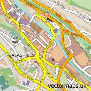
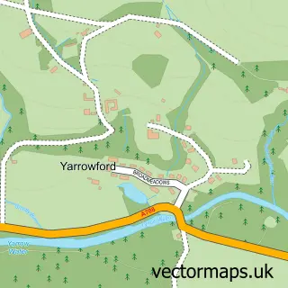
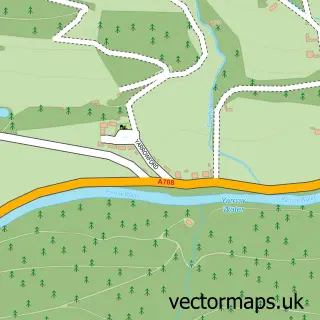
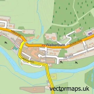
This Clovenfords street map is a detailed vector street map covering a 750m x 750m area. Select a larger area to create and download your own vector street map of Clovenfords.

Clovenfords is a village in Roxburgh, Ettrick And Lauderdale, in the South Scotland of Scotland. Historically, the area formed part of Selkirkshire. The settlement falls within the Berwickshire, Roxburgh And Selkirk parliamentary constituency. It is serve

The 750-metre map sample for Clovenfords covers 293 mapped buildings and approximately 16.3 km of road detail, of which 17 named roads are named. The wider area around Clovenfords features 1 hotel. To create a larger or custom map of Clovenfords, the map builder lets you define your own coverage area and download editable SVG, PDF and PNG files.

293Buildings
16.29 kmRoads
17Named roads
0Residents within 2 miles
Create your own

Create a larger editable map of Clovenfords

Choose any area you need and generate a high-quality vector map instantly. Perfect for print, planning, design, business and personal use.

Choose any location
Editable SVG files
Any size up to A0
PDF, PNG & more
Instant download
High quality guaranteed
Create My Custom Map
Secure, private & no credit card required
Clovenfords Vector Street Map
750m Sample
Clovenfords vector street map sample showing roads, buildings and local features in a 750 metre preview area
Buy Clovenfords Map Print from £12.95 Buy Clovenfords Digital Map from £6

This Clovenfords street map in Roxburgh, Ettrick and Lauderdale is available as downloadable SVG, PDF and PNG map files, or as a printed map for planning, business, display, education, local information and design work. You can also create a larger custom map area using the map selector.

What this Clovenfords map sample shows

Clovenfords lies within Scottish Borders parish, part of Tweeddale East ward in the Scottish Borders local authority area. The postcode geography for this area includes the TD postcode area, the TD1 postcode district and the TD1 3 postcode sector. Residents fall under the Borders for NHS services.

Local features near Clovenfords

Within 2 miles

Amenities and services in and around Clovenfords.

1 Hotels

Counts are approximate and based on publicly available data.

Administrative and postcode information for Clovenfords

The local authority covering Clovenfords is Scottish Borders, within the county of Roxburgh, Ettrick And Lauderdale. The settlement lies within Tweeddale East ward and Scottish Borders civil parish. The TD1 postcode district and TD1 3 postcode sector serve the immediate area. NHS provision in the area is delivered through Borders.

Parish SCOTTISH BORDERS
Ward Tweeddale East
District / local authority Scottish Borders
County Roxburgh, Ettrick and Lauderdale
Historic county Selkirkshire
Postcode district TD1
Postcode sector TD1 3
Parliamentary constituency Berwickshire, Roxburgh and Selkirk
Region South Scotland
Country Scotland

Nearby street map samples around Clovenfords

Street map sample of Galashiels, Roxburgh, Ettrick and Lauderdale Galashiels Town - Roxburgh, Ettrick and Lauderdale - 2.8 miles Street map sample of Edinburgh, City of Edinburgh Edinburgh City - City of Edinburgh - 26.1 miles Street map sample of Caddonfoot, Roxburgh, Ettrick and Lauderdale Caddonfoot Village - Roxburgh, Ettrick and Lauderdale - 0.9 miles Street map sample of Lindean, Roxburgh, Ettrick and Lauderdale Lindean Village - Roxburgh, Ettrick and Lauderdale - 4.1 miles Street map sample of Tweedbank, Roxburgh, Ettrick and Lauderdale Tweedbank Village - Roxburgh, Ettrick and Lauderdale - 4.4 miles Street map sample of Broadmeadows, Roxburgh, Ettrick and Lauderdale Broadmeadows Village - Roxburgh, Ettrick and Lauderdale - 4.5 miles Street map sample of Yarrowford, Roxburgh, Ettrick and Lauderdale Yarrowford Village - Roxburgh, Ettrick and Lauderdale - 4.7 miles Street map sample of Stow, Roxburgh, Ettrick and Lauderdale Stow Village - Roxburgh, Ettrick and Lauderdale - 5.2 miles Street map sample of Darnick, Roxburgh, Ettrick and Lauderdale Darnick Village - Roxburgh, Ettrick and Lauderdale - 5.3 miles Street map sample of Walkerburn, Tweeddale Walkerburn Village - Tweeddale - 5.5 miles

More street maps in Roxburgh, Ettrick and Lauderdale

Street map sample of Caddonfoot, Roxburgh, Ettrick and Lauderdale Caddonfoot Village - 0.9 miles Street map sample of Galashiels, Roxburgh, Ettrick and Lauderdale Galashiels Town - 2.8 miles Street map sample of Lindean, Roxburgh, Ettrick and Lauderdale Lindean Village - 4.1 miles Street map sample of Tweedbank, Roxburgh, Ettrick and Lauderdale Tweedbank Village - 4.4 miles Street map sample of Broadmeadows, Roxburgh, Ettrick and Lauderdale Broadmeadows Village - 4.5 miles

750 metre map area coverage

Boundary, postcode and point of interest information for the 750m x 750m rectangle centred on this sample map.

Boundaries containing map centre

Constituency: Berwickshire, Roxburgh and Selkirk Co Const

District: Scottish Borders

Icb: Borders

Postcode District: TD1

Postcode Sector: TD1 3

Ward: Tweeddale East Ward

Nearby boundaries intersecting sample

Postcode Sector: TD1 1

Postcode coverage

TD1 TD1 3 TD1 1

POI category counts

Beauty Salon: 2

Elementary School: 2

Carpet Store: 1

Chiropractor: 1

Community Center: 1

Convenience Store: 1

Counseling And Mental Health: 1

Holiday Rental Home: 1

Home Cleaning: 1

Hotel: 1

Sample points of interest

  • Beau Boutique Beauty Salon
  • Sunshine Skin Beauty Salon
  • Borders Flooring Services Carpet Store
  • Trust Chiropractic Clinic Chiropractor
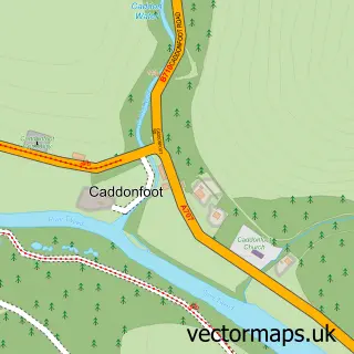
  • Caddonfoot Village Hall Community Center
  • Clovenfords Post Office Convenience Store
  • Mindfulness Skills4Life Counseling And Mental Health
  • Caddonfoot Primary School Elementary School
  • Clovenfords Primary School Elementary School
  • Juniper Cottage Holiday Rental Home
  • CG Cleaning Systems Home Cleaning
  • The Clovenfords Hotel Hotel

Create a larger editable map of Clovenfords

This sample shows only a 750 metre area. To create a larger map of Clovenfords, use our map builder to choose your own coverage area, add titles and download editable SVG, PDF and PNG files.

Create a custom map of Clovenfords

Phone 01751 473136 | Copyright Vectormaps.uk 2026

Samples Customizer Privacy Disclaimer
Clovenfords Vector Street Map
Clovenfords enlarged street map sample showing a 750 metre preview area